BORGOSESIA, fraz. Bettole – Monte Fenera
Route / Trekking
Hikes
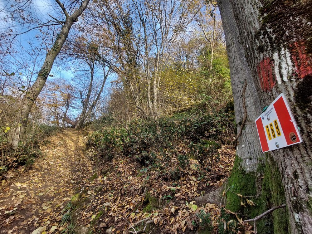
trail n. 769 Bettole – Monte Fenera
Difficulty: medium
average duration: 1 – 2 hours
departure altitude: 350 mt
arrival altitude: 899 mt
altitude difference: 549 mt
Route description
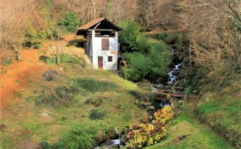
An easy mule track joins the old railway station in the hamlet of Bettole, 350m, with the hamlet of Fenera San Giulio, 414m, in about fifteen minutes. (You can also get to the hamlet of Fenera San Giulio by car, where you will find a parking lot at the end of the road.)
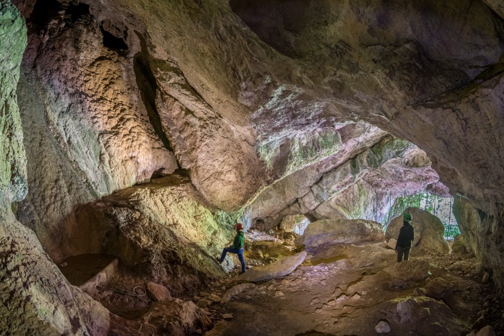
Here you take a flight of steps in front of the parking lots that crosses cultivated meadows and begin to climb, passing the houses of the hamlet until you reach the wide gravel road that, after a few meters, turns right until it joins the path that climbs into the woods. Following the path that zigzags uphill, at an altitude of 610m you will find on the right the detour to the Ciutarùn cave, which can be reached in a short time and is protected by a gate.
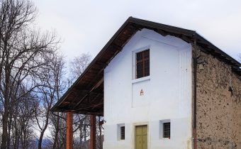
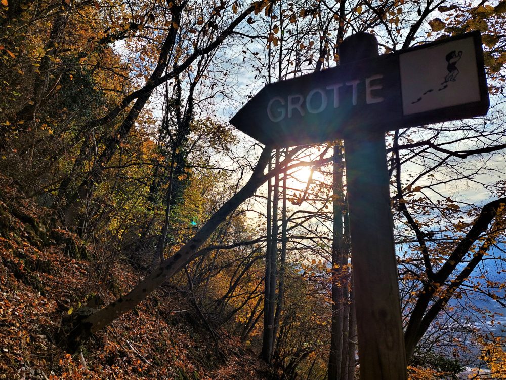
Proceeding instead on the path, after a few tens of meters there is a gully, the crossing of which requires attention and caution, due to the possible fall of stones and the slipperiness of the ground. At the top you turn left. From here you can catch a glimpse of the Ciota Ciara cave. On the right, on the other hand, you can reach the Belvedere sub-rock and a little further on, climbing a steep metal ladder, you can reach the GASB (Archaeological Speleological Group of Borgosesia) Shelter. Nearby comes path 780 coming from Ara: for those who do not want to climb the metal ladder, can take this path for a few meters, descend a wooden staircase, continue a little straight ahead and, immediately on the left, climb a path that leads behind the refuge.
Returning instead to the main itinerary, then at the fork, continue on the left, flanking the rock face and reaching the karst cavities: the most relevant is the Ciota Ciara.
The route proceeds with a short traverse uphill until it reaches the cave known as Buco della Bondaccia at an elevation of 690m. Entering a karst basin and turning right, it climbs the wooded flank until it crosses with path 768; follow it for a few meters and then leave it, veering right again and continuing to the saddle that divides the two peaks of the mountain. Here also coincides the arrival of path 768 that we previously met and of path 772 coming from Colma and Grignasco.
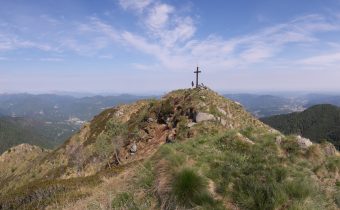
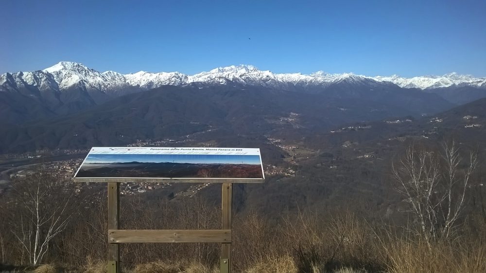
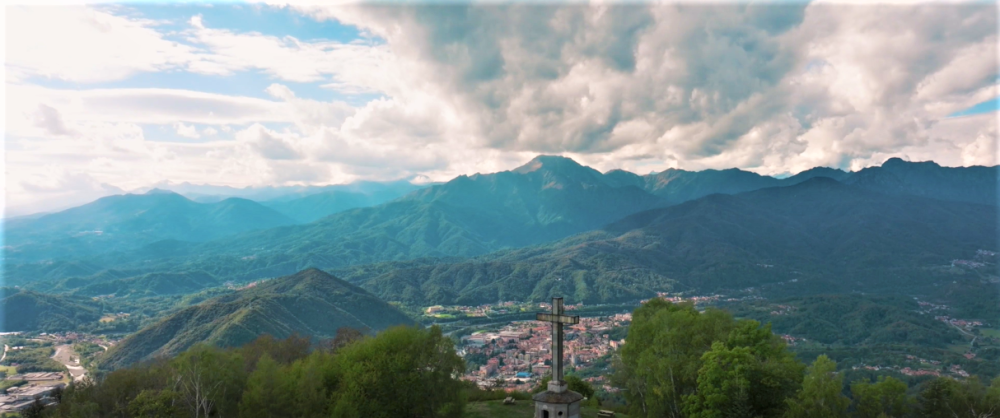
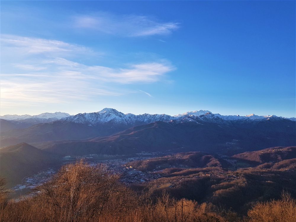
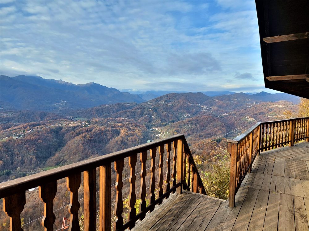
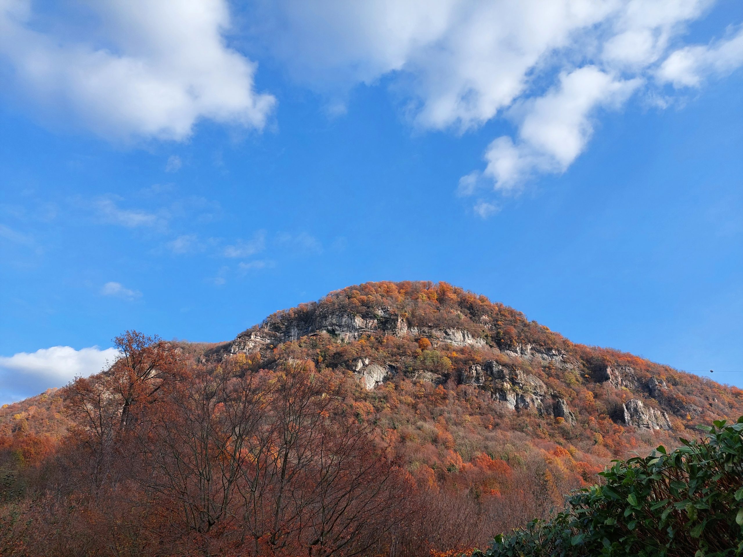
Continuing to keep to the right for about a hundred meters we reach the stone cross located on Cima Bastia, 899m, the culminating point of Mount Fenera from which to enjoy a 360° panorama of Borgosesia and most of the Alps.
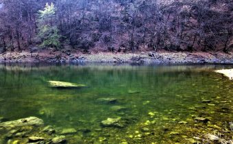
The Mount Fenera territory became part of the regional system of protected areas in 1987 with the establishment of the Mount Fenera Natural Park and covers an area of 3378 hectares. The park takes its name from the mountain of the same name, which rises, mighty and lonely, above the foothills of Lower Valsesia and whose profile is recognizable from the Novara and Vercelli plains. Mount Fenera, has on its western slopes numerous caves, some of which are of considerable archaeological and paleontological interest, as they have revealed unique signs in Piedmont of the presence of the Neanderthal man, who lived in these places about 300,000 years ago, the Cave Bear and Merk’s Rhinoceros.
Other routes
recommended
Valsesia has a lot to offer to hiking enthusiasts
Suggestive trails surrounded by nature that offer breathtaking views: be surprised by the beautiful mountains of Valsesia!