CARCOFORO – Colle d’ Egua
Route / Trekking
Hikes
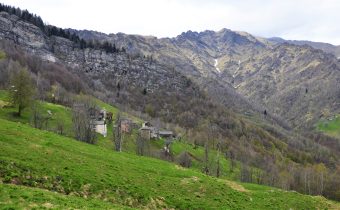
trail n. 122 Carcoforo – Colle d’ Egua
Difficulty: medium
average duration: 2 – 3 hours
departure altitude: 1304 mt
arrival altitude: 2239 mt
altitude difference: 935 mt
Route description
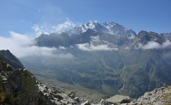
It is one of the classic historic traverse routes to connect Carcoforo with the Mastallone Valley and the Anzasca Valley. It is part of the route of the Great Traverse of the Alps (GTA), the Great Walser Trail, the Via Alpina and the Cai Italia Trail.
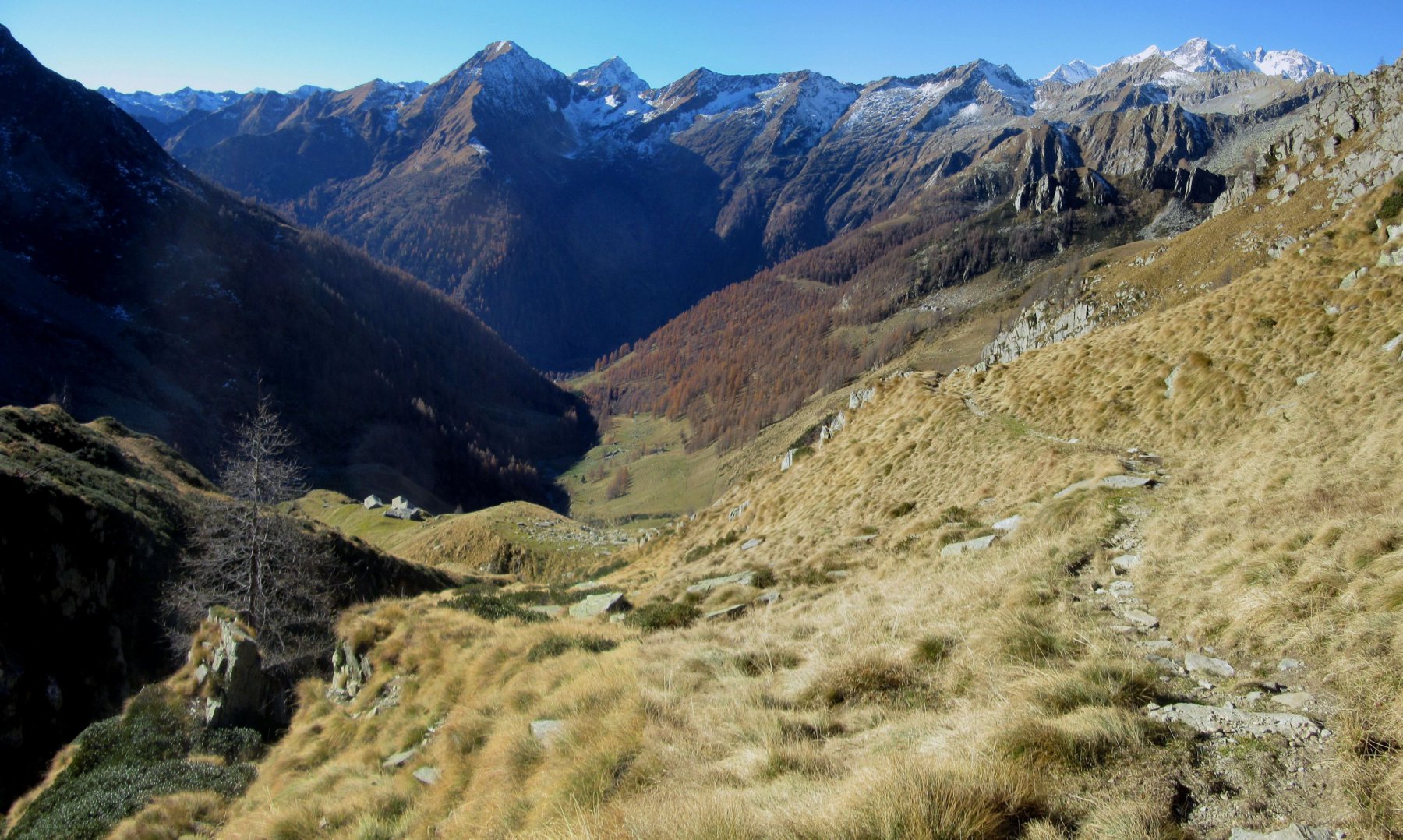
From the center of Carcoforo, located on the hydrographical right side of the Egua stream, continue toward the houses upstream of the village, then rising through meadows and passing by the little Torbe chapel. One enters Val d’Egua continuing with a moderate climb finding a larch grove on the left. You cross the Rio Passone, a affluent of the Egua, leaving the alpine huts of Alpi Giacc and Casera Bianca, 1523m, in the valley, leading to Alpe Piovale, 1637m. Climbing a few more meters, at 1685m rises the Boffalora Majerna hut, reachable in about an hour.
The trail then grazes Alpe Egua, 1799m, and reaches Alpe Sellette, 1915m.
From here, keeping to the left ridge, it reaches Colle d’Egua, 2239m, in about 2h30/3 hours total.
In 2013 a stone building was inaugurated near the col to house the Volpone-Sesone Bivouac, equipped with 12 beds, stove, stove and services.
Descending the northeast slope you enter the Mastallone Valley (route 517) and, having reached Alpe Selle, 1824m, you can descend to the right through the Baranca Valley to Fobello.
Other routes
recommended
Valsesia has a lot to offer to hiking enthusiasts
Suggestive trails surrounded by nature that offer breathtaking views: be surprised by the beautiful mountains of Valsesia!