RIVA VALDOBBIA, Fraz. Sant’Antonio – Alpe Maccagno
Route / Trekking
Hikes
trail n. 205 S. Antonio – Alpe Maccagno
difficulty: medium
average duration: 3 hours
departure altitude: 1380 mt
arrival altitude: 2188 mt
altitude difference: 808 mt
Route description
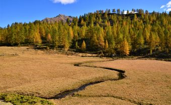
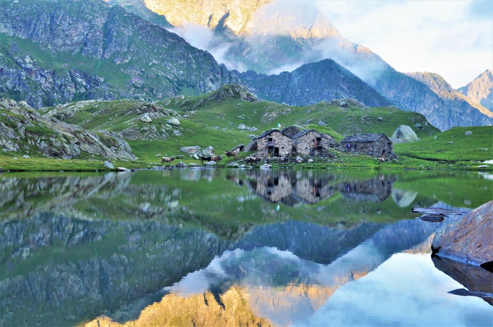
Alpe Maccagno, renowned for its historic alpine pasture, lies on a grassy plain in a wide and bright basin. The cheese produced in this pasture, Toma Maccagno, is considered special and unique, and for this reason mentioned in almost every alpine and tourist guidebook in the area since the 19th century.
To reach the starting point of this itinerary, from the village of Riva Valdobbia you follow the paved carriage road to the hamlet of Ca’ di Janzo, continuing then always on the road (partially subjected to transit restrictions, during the summer season) to the hamlet of Sant’Antonio, where you can park your car (arrival point of the Ca di Janzo – Sant’Antonio summer shuttle).
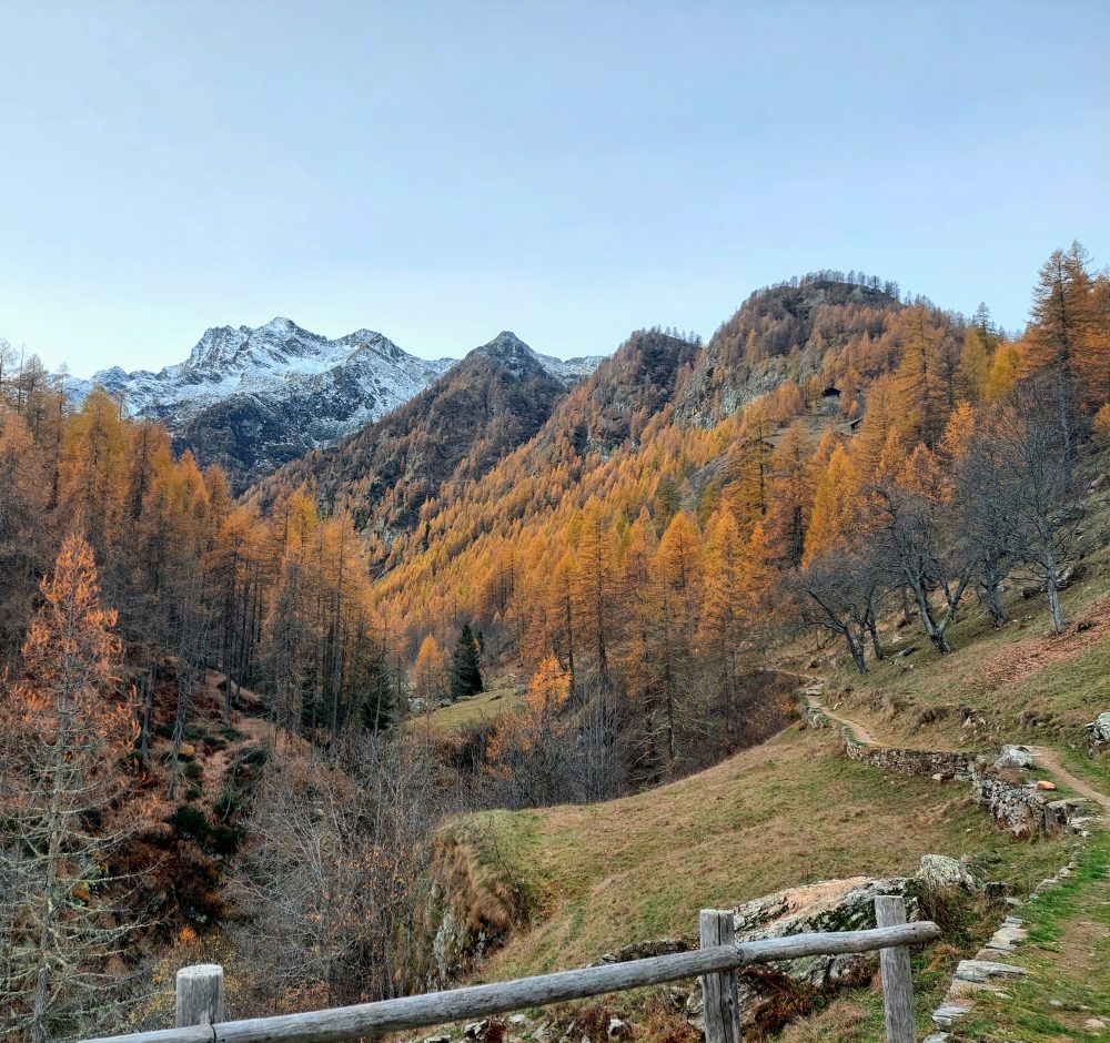
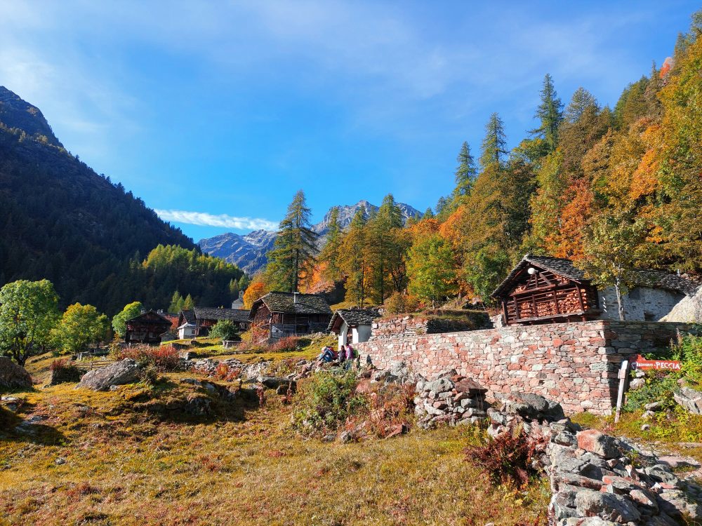
Starting on foot on the unpaved road past the houses and small church of the hamlet, follow the old path to Aosta with the 201 marker. At the end of the dirt road you reach the hamlet of Peccia, with its characteristic Walser houses and beautiful small lake. Continuing on the path to the right that passes between the small houses, just past the small church of the Oratory of San Grato, you pass the old Napoleonic-era bridge (reachable in about an hour from Sant’Antonio). Immediately afterwards, leaving the mule track to the right that leads to Alpe Larecchio and Colle Valdobbia, our itinerary begins.
After the Napoleonic bridge we turn left and cross the Maccagno stream on the wooden bridge. The mule track flanks the stream almost level for a good stretch, while it climbs with a high-stepping ramp, crossing the Rio Tillio and arriving at Alpe Buzzo Inferiore, 1698m (here we leave out itinerary 206 on the left, which leads to the Alpe and Lake Tillio, 2207m).
Go straight on past the Alpe Buzzo Superiore casera, 1718m, and reach Alpe Pioda di Sotto, 1830m, and Alpe Pioda di Sopra, 1877m (from where with route 205a you can climb to the Alpe, Lake and Bocchetta del Cortese, 2562m). Past the alpine pasture, cross the bridge and continue along the ascent that leads to the plateau of Alpe Camino, 2031m.
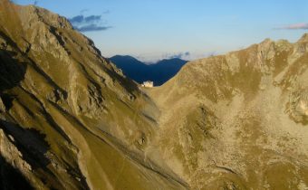
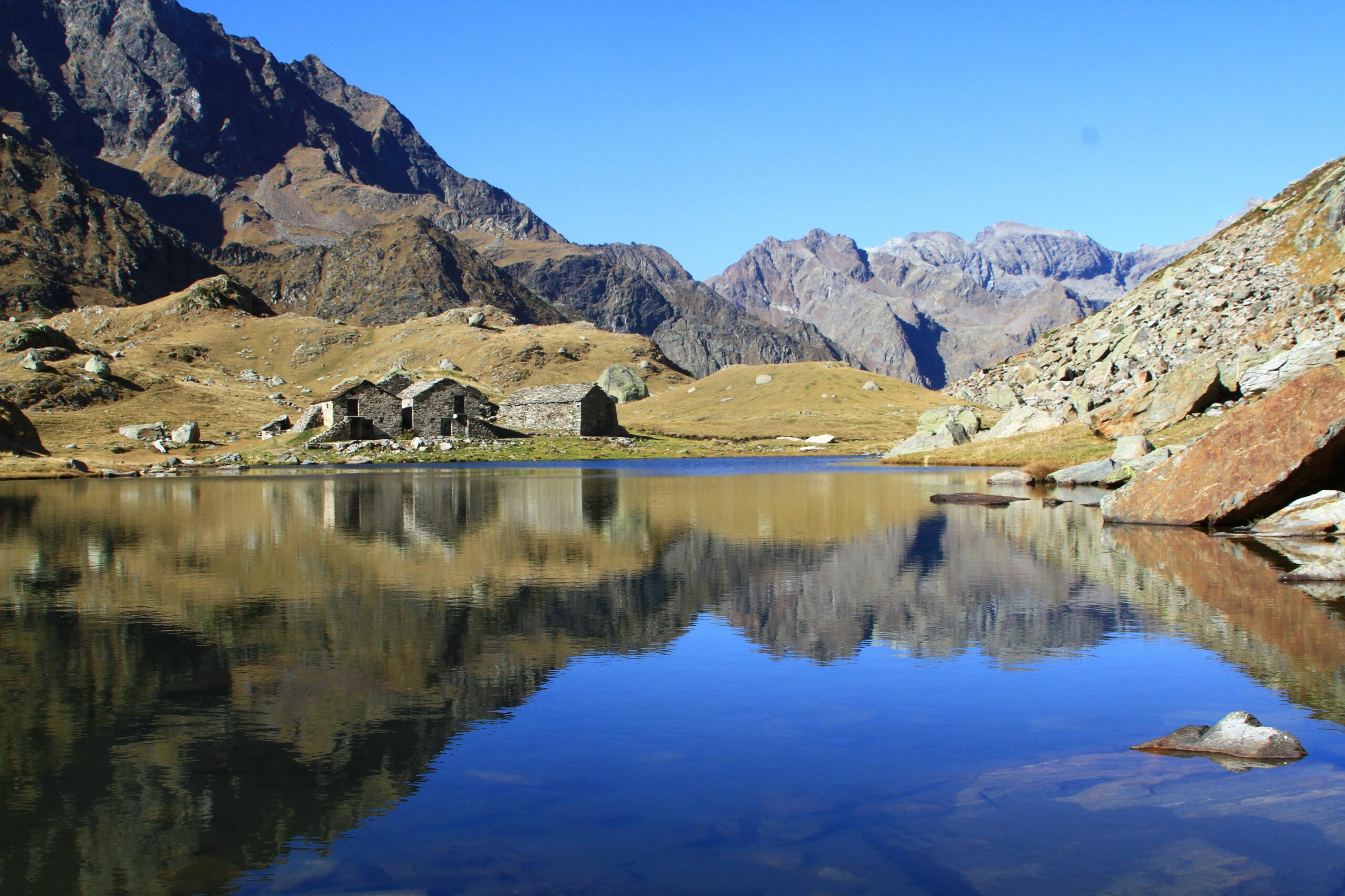
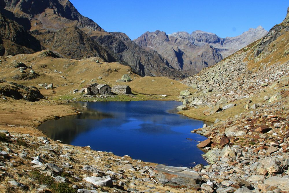
Continuing for a stretch uphill and then almost flat, you reach Alpe Maccagno, 2188m (in about 3 hours total). From here you can enjoy the view that this picturesque alpine pasture, which is mirrored in a small lake, is able to give!
Wanting to continue further and climb further, one can enter the small valley, passing some ponds, to reach Black Lake, 2322m (about 3h30). A final climb leads to the Maccagno Pass, 2493m (about 4h).
From the Pass, the trail descends to the Piani di Loo from where you can reach the hamlets of Loomatto and Champsil, in the Lys Valley (Gressoney) with itinerary 12b. From the Piani you can also climb left to the Loo Pass, from where you can descend through the Sorba Valley to Rassa along Trail 251.
Other routes
recommended
Valsesia has a lot to offer to hiking enthusiasts
Suggestive trails surrounded by nature that offer breathtaking views: be surprised by the beautiful mountains of Valsesia!