RIVA VALDOBBIA, Fraz. Sant’Antonio – Alpe Larecchio
Route / Trekking
Hikes
trail n. 201a Peccia – Alpe Larecchio
Difficulty: medium – easy
average duration: 2 hours
departure altitude: 1380 mt
arrival altitude: 1895 mt
altitude difference: 515 mt
Route description
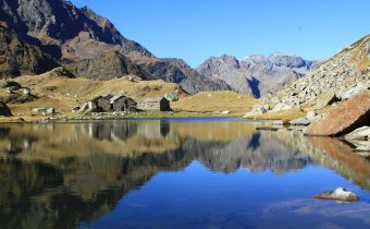
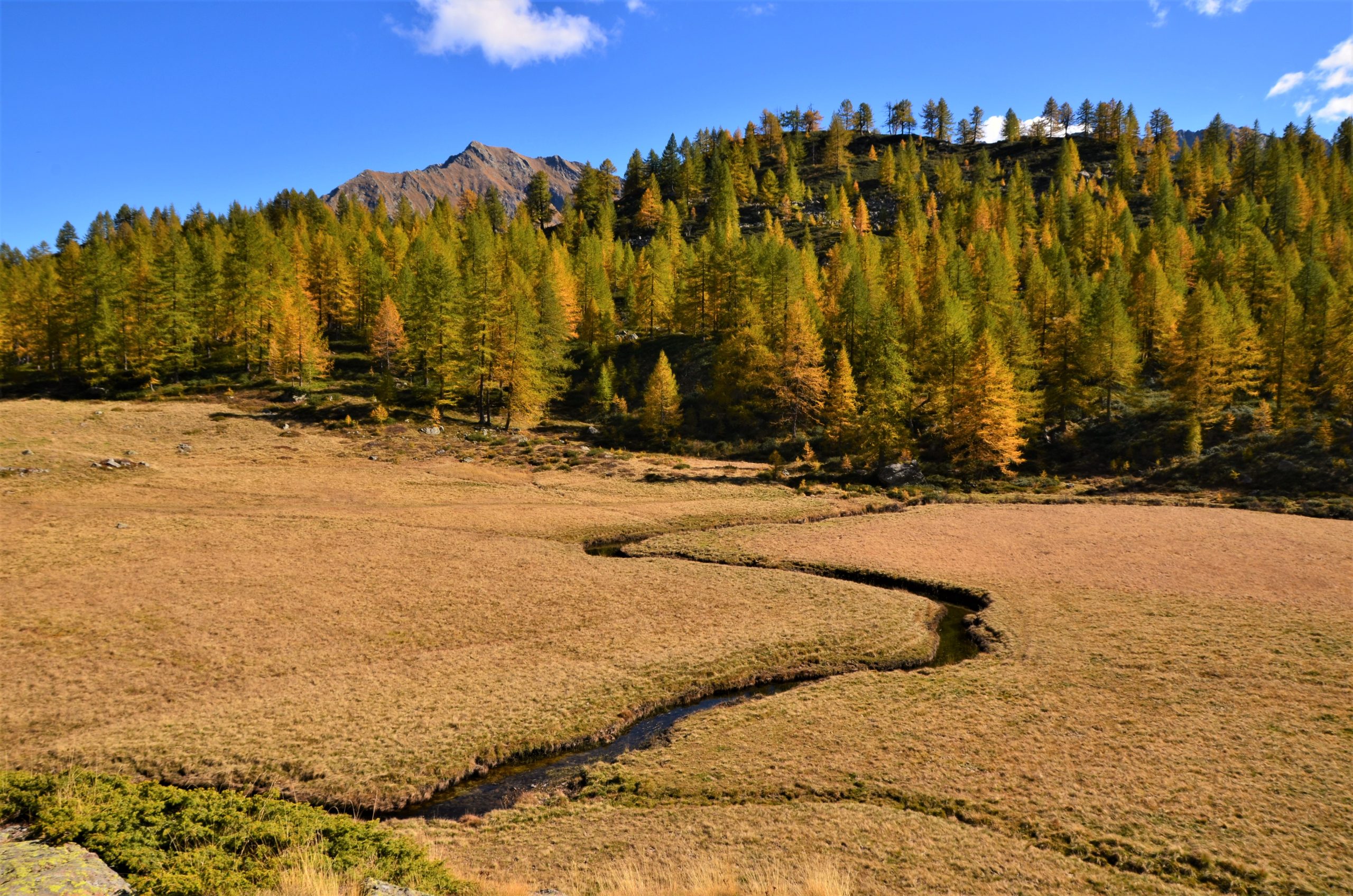
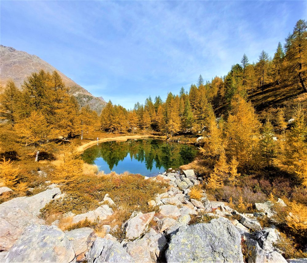
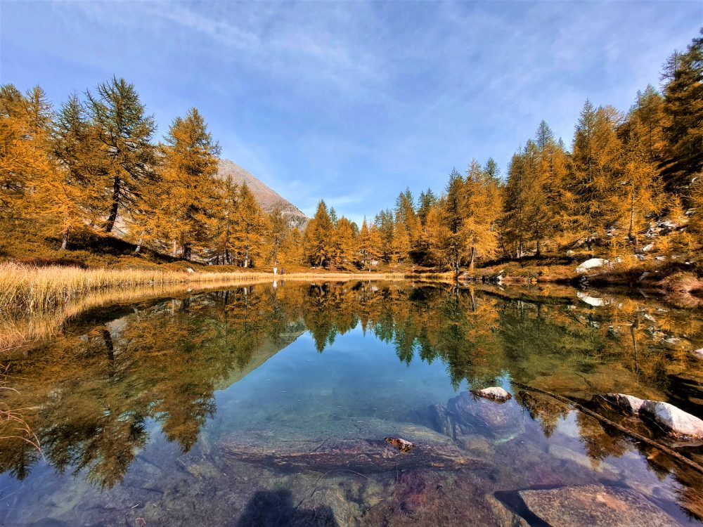
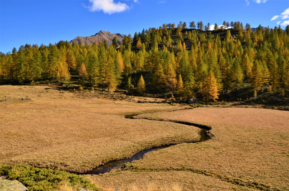
This route is one of the variants found on the way to the Valdobbia Pass, leading to Alpe Larecchio, one of the most beautiful pastures in Valsesia. Its small lake surrounded by larch trees and the wide plateau crossed by the distinctive serpentine created by the passage of the Valdobbia stream make it a beloved and fascinating destination, especially during the colorful fall season!
To reach the starting point of this itinerary, from the village of Riva Valdobbia you walk along the paved carriage road to the hamlet of Ca’ di Janzo, continuing then always on the road (partially subjected to transit restrictions, during the summer season) to the hamlet of Sant’Antonio, where you can park your car (arrival point of the Ca di Janzo – Sant’Antonio summer shuttle).
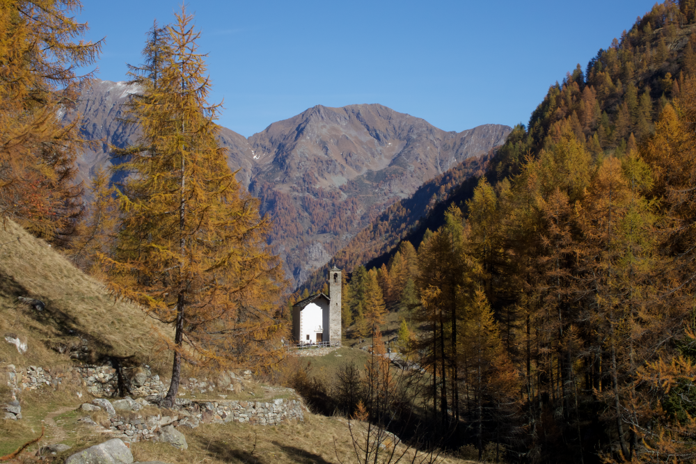
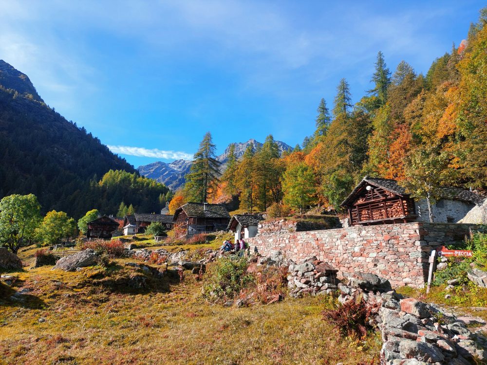
Starting on foot on the dirt road past the houses and the hamlet’s small church, follow the old route to Aosta with the 201 marker. At the end of the dirt road you reach the hamlet of Peccia, with its characteristic Walser houses and beautiful small lake. Continuing on the path to the right that passes between the small houses, just beyond the small church of the Oratory of San Grato, you pass the old Napoleonic-era bridge (reachable in about an hour from Sant’Antonio).
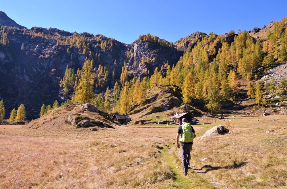
Then take the path that climbs to the right toward La Montata, 1638m, then reaches the two huts of Alpe Tecchiale, and climbs to the little Lancone chapel, 1739m. Further up, inside the larch forest, you reach the junction with the mule track to Colle Valdobbia, which you leave on the right. Then continue left along a good path in the larch forest that soon leads to Alpe Larecchio, 1895m (about 2 hours in total), a splendid and picturesque alpine pasture, which houses a farmhouse.
The origin of the name derives precisely from the many larch trees that surround the alp: one of these large trees stands on a large rock in the center of the basin, from which one can enjoy the special view of the wide plateau. Following the particular path of the small stream that crosses the alp, one can reach the charming little lake located a little higher up.
From the farm building, you can climb up to Pian del Celletto, at about 2100m (0.30-2.45 hours), where you will find the 201 trail leading to Ospizio Sottile again.
Other routes
recommended
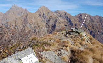
Valsesia has a lot to offer to hiking enthusiasts
Suggestive trails surrounded by nature that offer breathtaking views: be surprised by the beautiful mountains of Valsesia!