RIVA VALDOBBIA, Fraz. Sant’Antonio – Corno Bianco
Route / Trekking
Hikes
trail n. 202 S. Antonio – Corno Bianco
Difficulty: EEA – Experienced Hikers with Equipment
average duration: 5-6 hours
departure altitude: 1380 mt
arrival altitude: 3320 mt
altitude difference: 1940 mt
Route description
This route is the main route to Corno Bianco, one of the most important and scenic peaks in Valsesia! Caution: basic mountaineering skills are required beyond Black Lake.
To reach the starting point of this itinerary, from the village of Riva Valdobbia, walk along the paved carriage road to the hamlet of Ca’ di Janzo, then continue always on the road (partially subject to transit restrictions, during the summer season) to the hamlet of Sant’Antonio, where you can park your car (arrival point of the Ca di Janzo – Sant’Antonio summer shuttle).
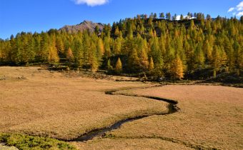
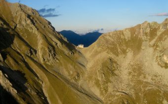
Starting on foot on the dirt road past the houses and the little church of the hamlet, follow trail marker 201 to the junction at an altitude of about 1400m (reachable in about 30min). Here the path begins by climbing to the right, indicated by some CAI signs and the wooden sign of the refuge. You then reach the hamlet of Cambiaveto, which you immediately leave to take the path to the left that climbs and crosses the valley. Turning left you pass above the hamlet of Piane, 1494m. You cross the pasture and face the tightly winding ascent that leads to Alpe Spinale, 1904m. With another uphill stretch you reach the Carestia Refuge, 2201m (in about 2 hours). The trail continues high up the mountainside, accompanied by beautiful views of the Rissuolo waterfall, Rifugio Ospizio Sottile and Alpe Larecchio. Leaving the ruins of Alpe Pile Vecchie below, you cross a stream in the scree and arrive at the former Alpe Rissuolo Support Point, 2264m.
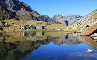
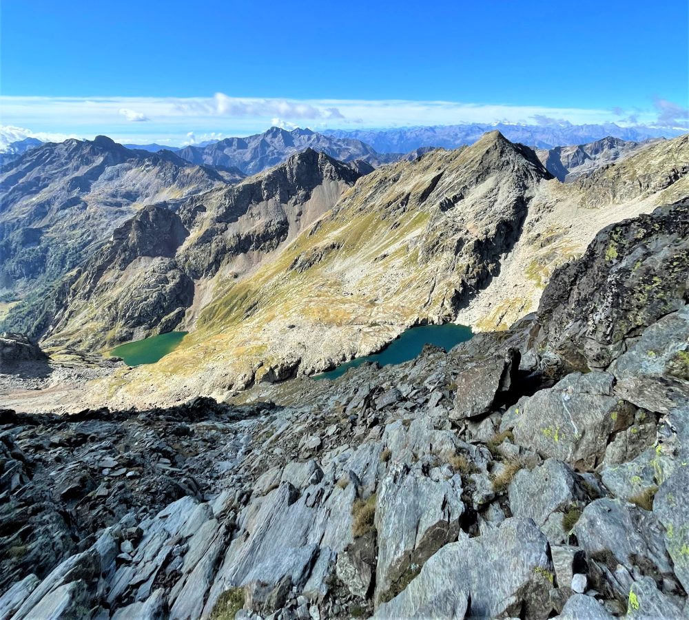
You then enter Vallone Rissuolo, passing the waterfall and flanking the stream to shortly reach Lago Bianco, 2333m (about 2h30). Go around it passing a rocky spur and continue on scree. When you reach the bottom of the basin, you tackle the steep slope of meadows and slabs that leads to the upper shelf where the barren Black Lake, 2672m (about 3h30), is situated.
From here you head north to a black: some fixed chains and appropriate handholds allow you to cross this aerial and exciting passage.
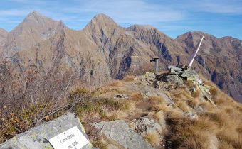
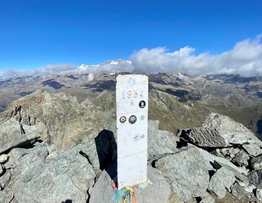
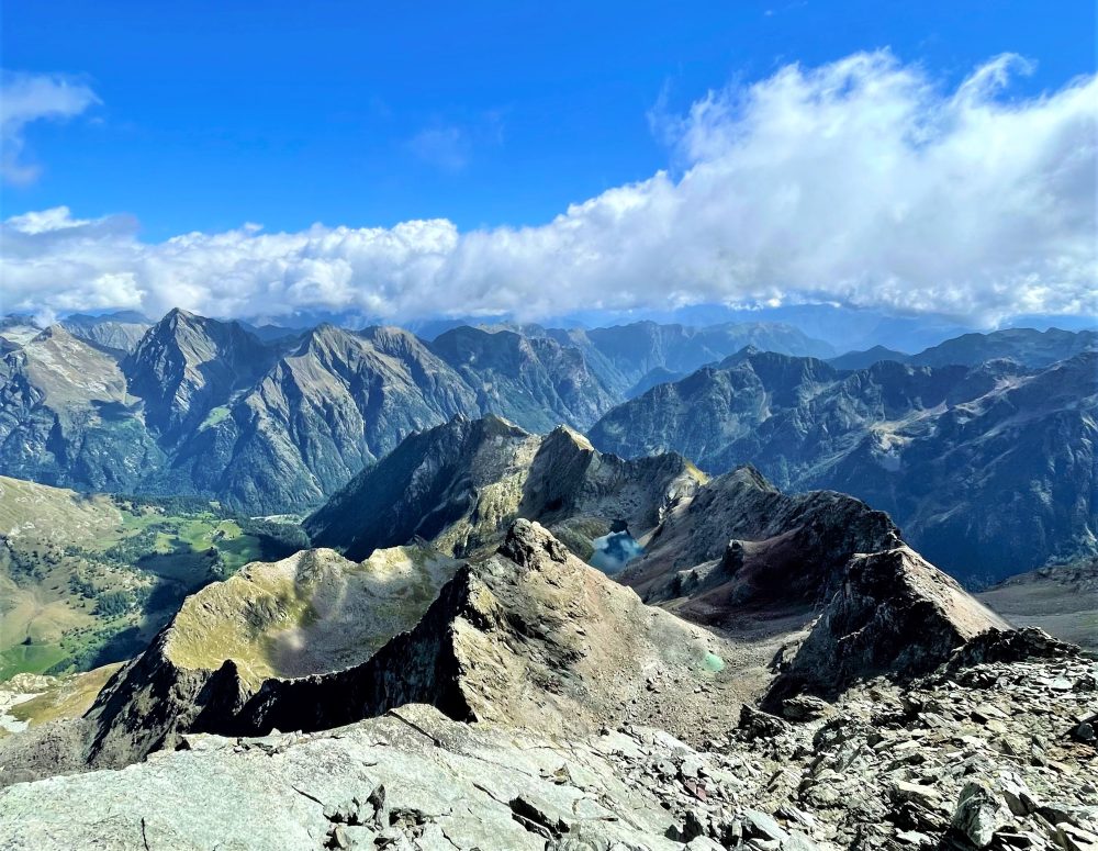
You ascend the overhanging gully and about halfway up take a left into a parallel gully. Following the southeast ridge, with a route over exposed rocks, climb to the summit of Corno Bianco, 3320m (total about 6 hours).
From the summit the view is exciting and unique: it overlooks the alpine circle, the plain and especially the southern slope of Monte Rosa. Although the ascent has some difficulties and a long way to go, the great variety of landscapes, alpine lakes and views definitely repay the effort!
Other routes
recommended
Valsesia has a lot to offer to hiking enthusiasts
Suggestive trails surrounded by nature that offer breathtaking views: be surprised by the beautiful mountains of Valsesia!