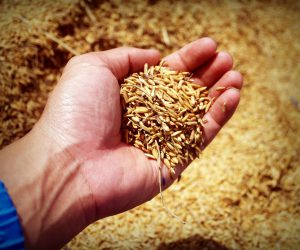
Baraggia rice PDO
#losapevateche
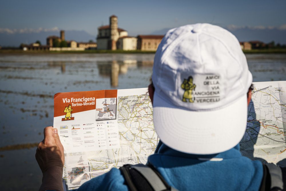
Exploring the Baraggia
Itinerary The lands of rice
rice, Castles
and nature
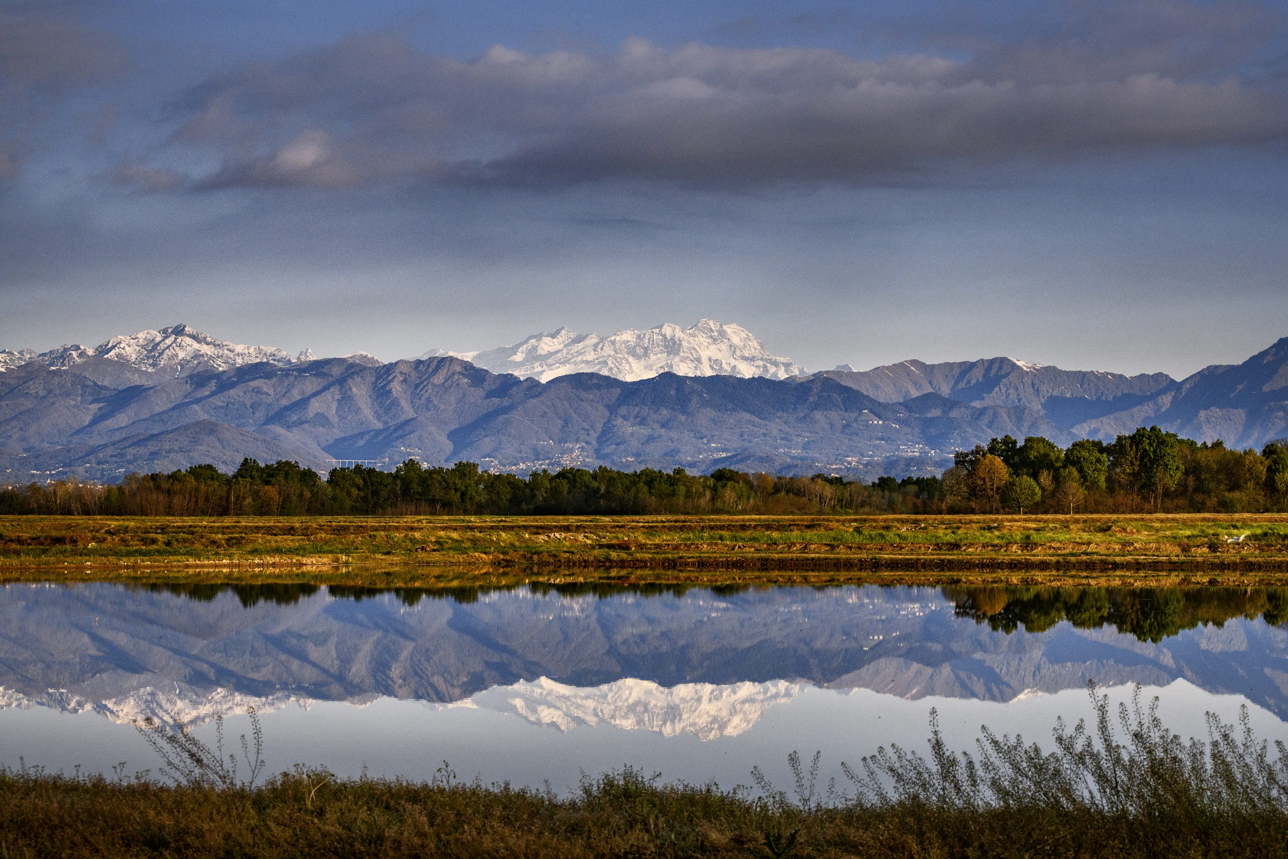
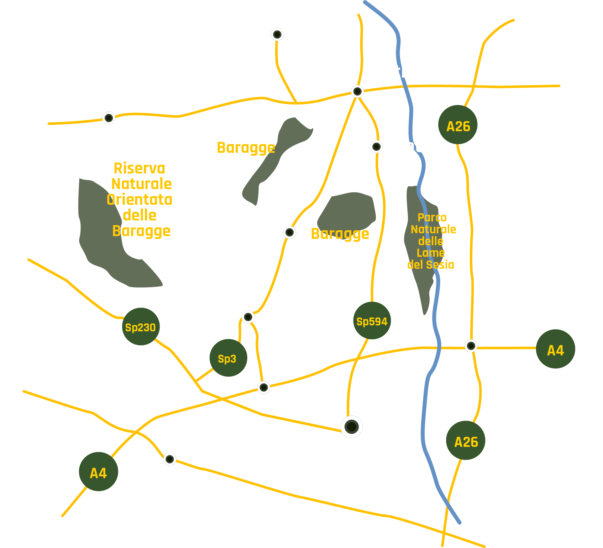
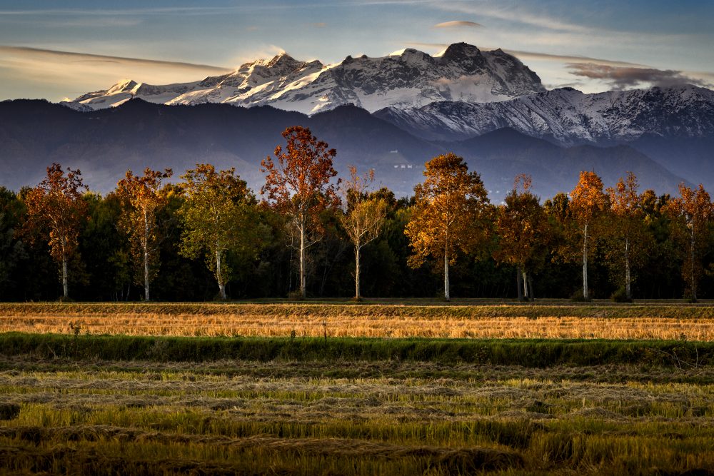
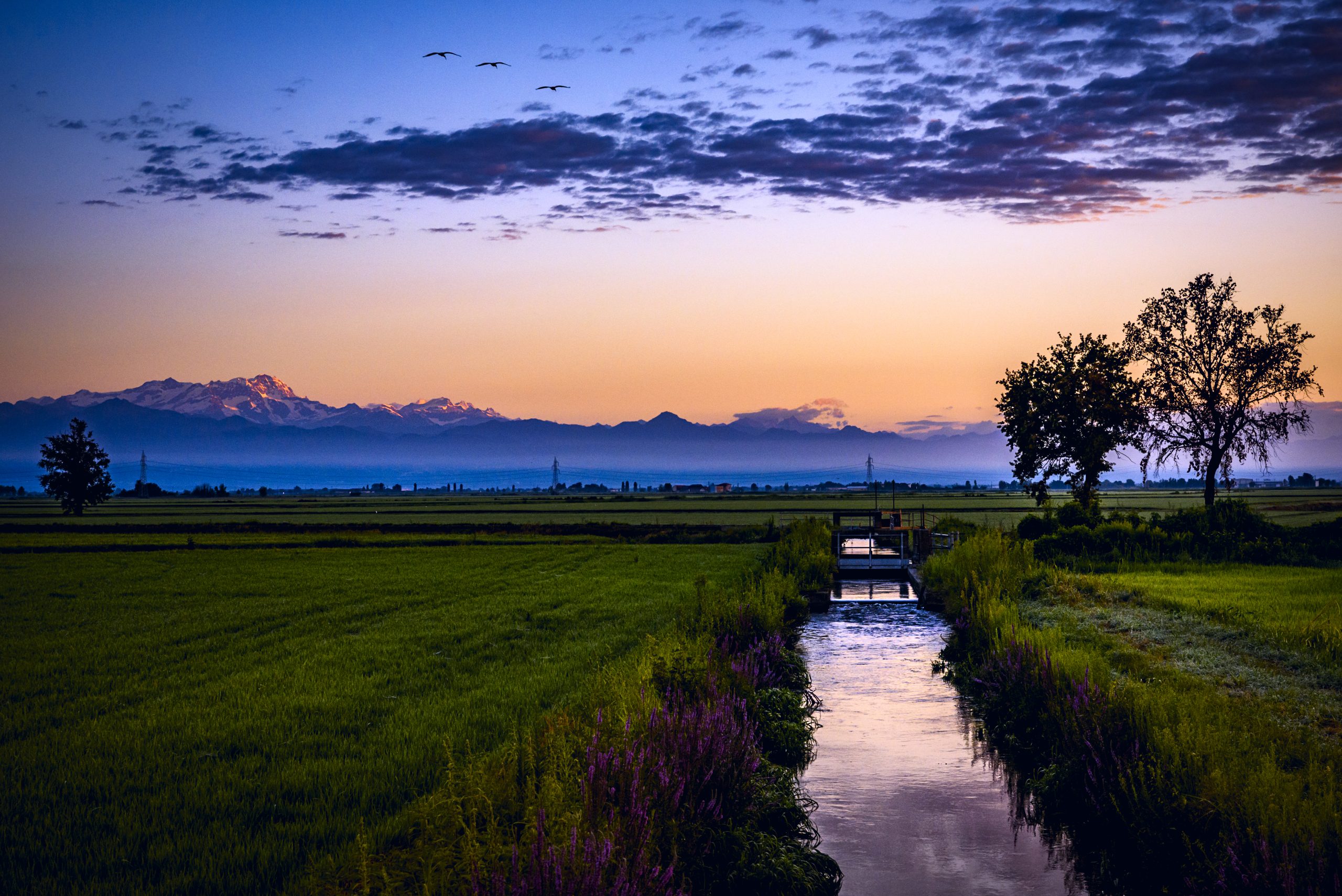
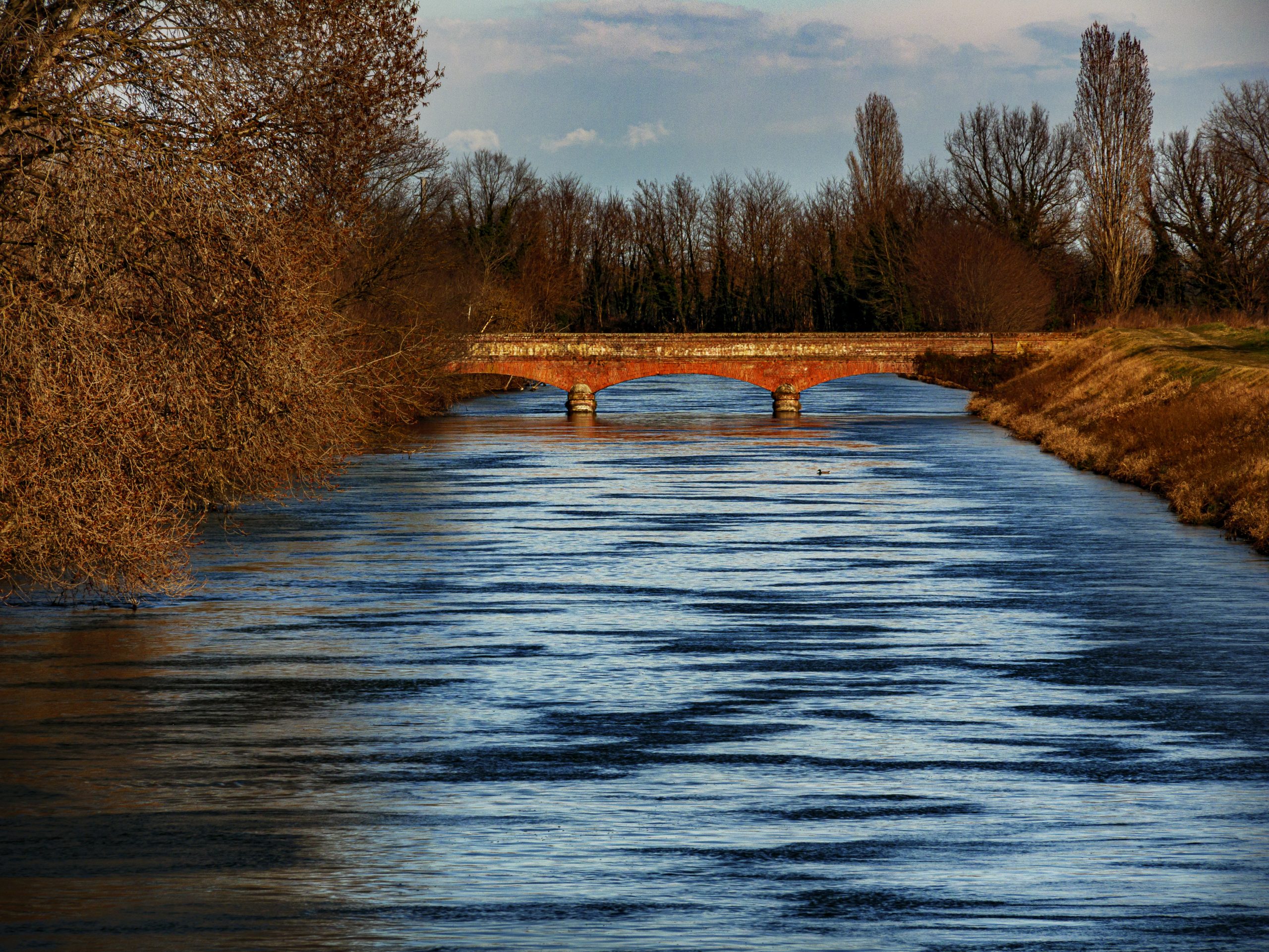
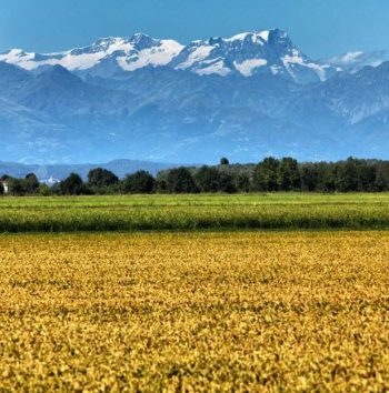
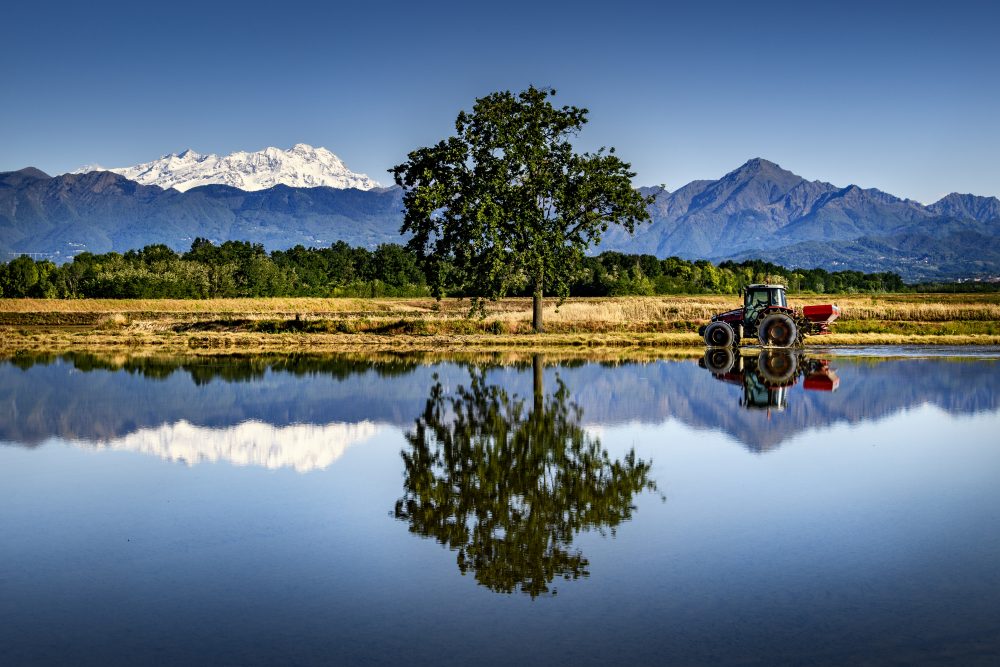
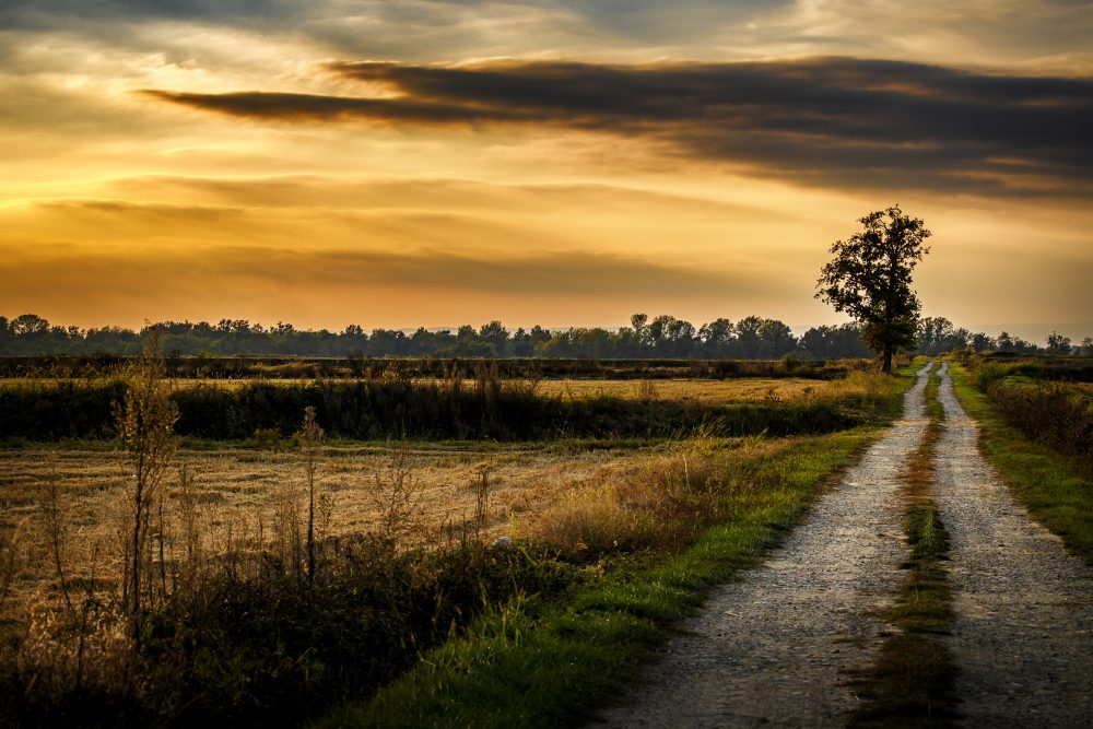
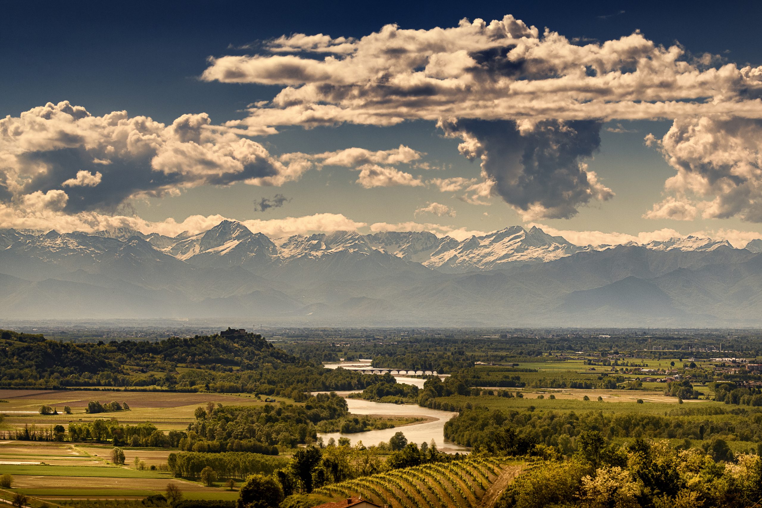
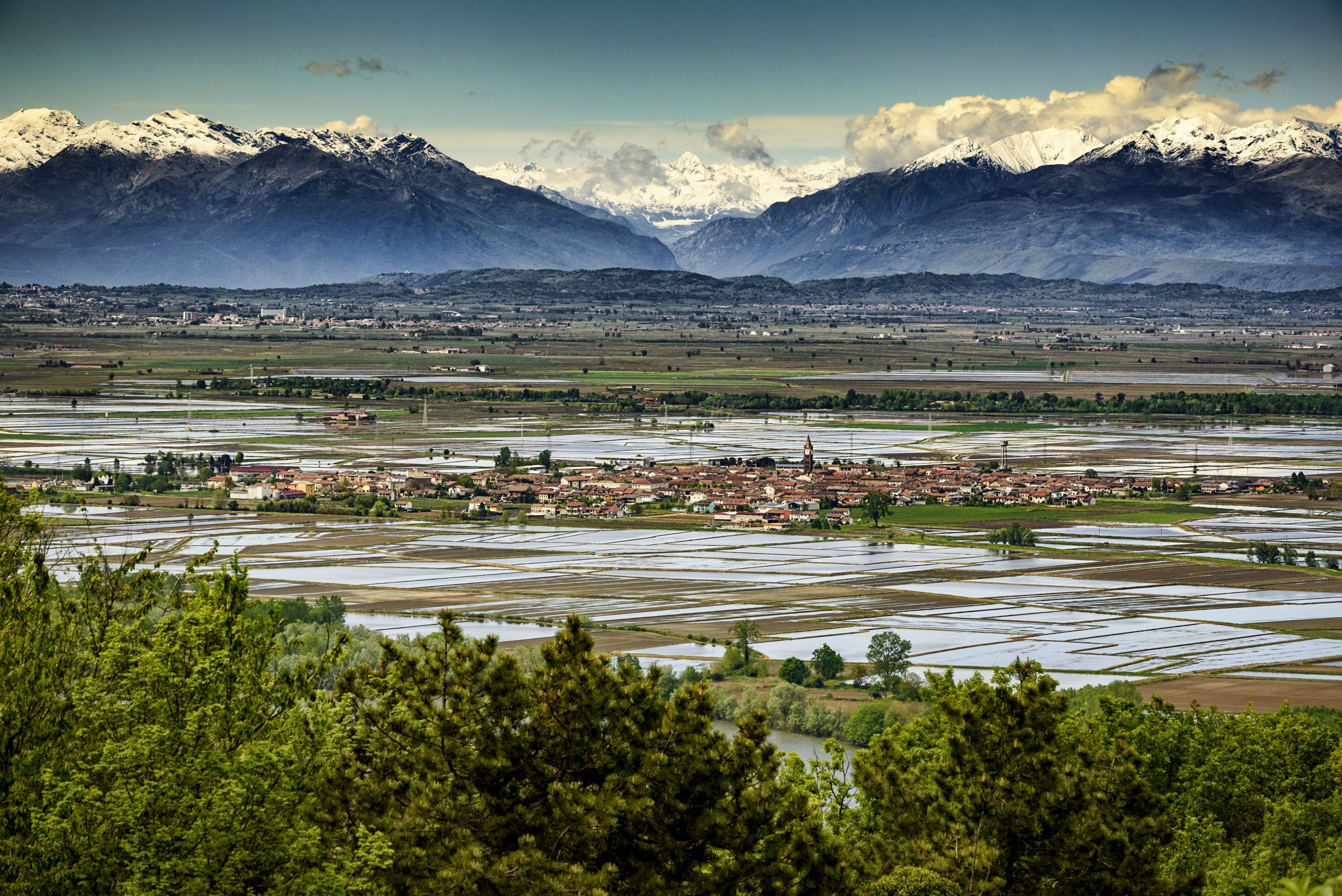
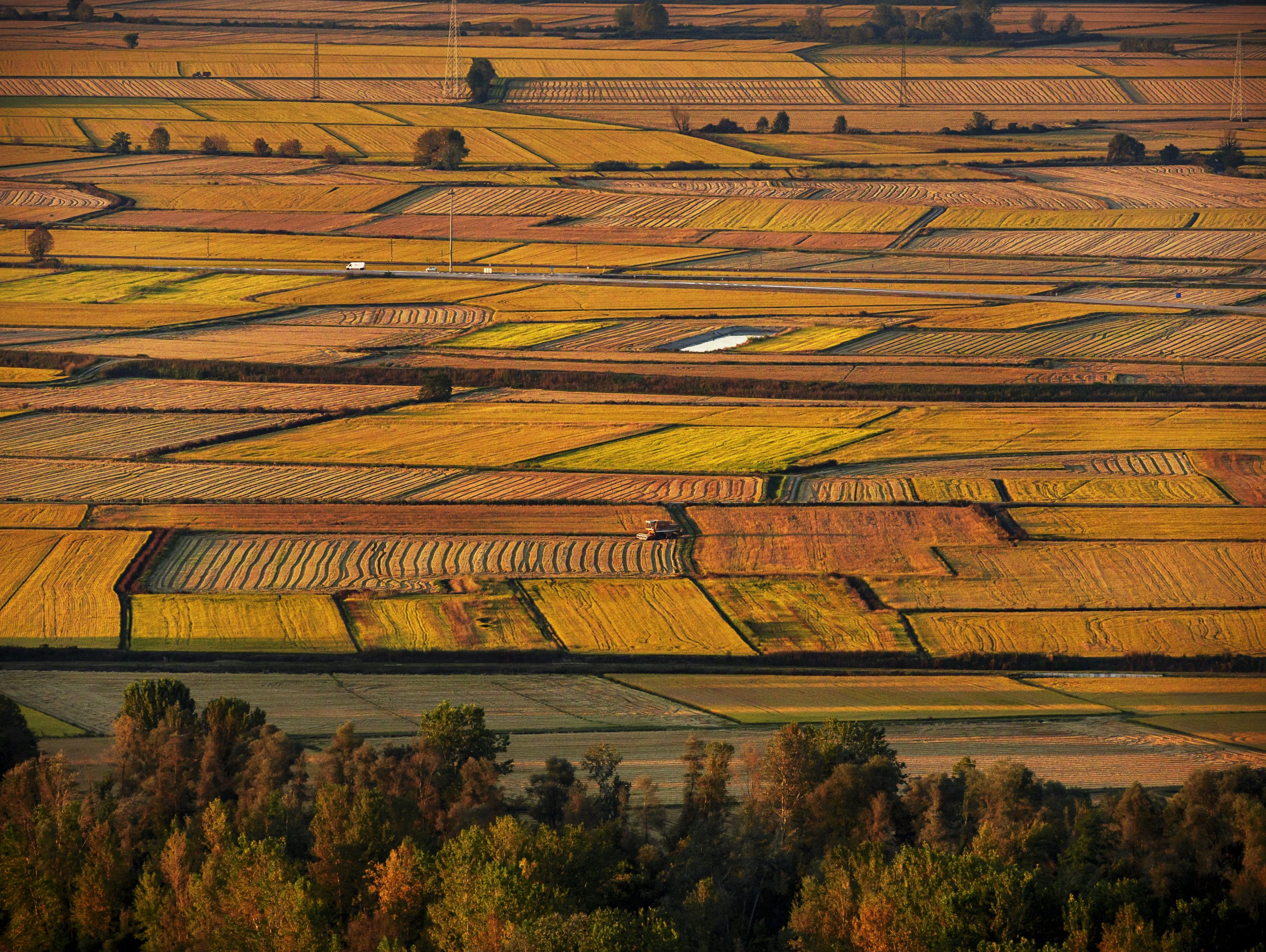
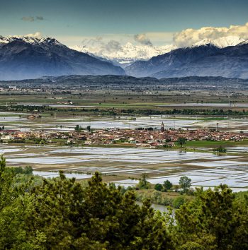
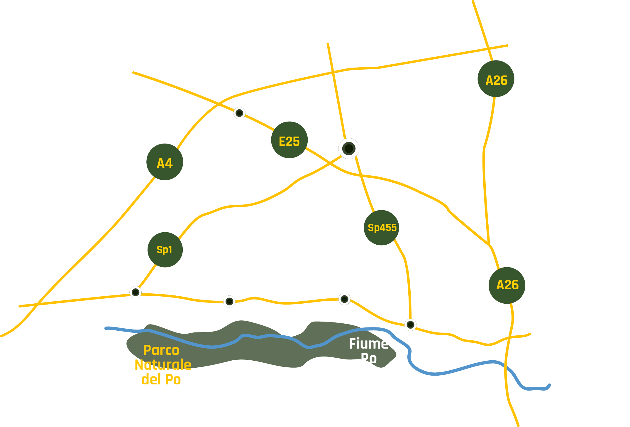
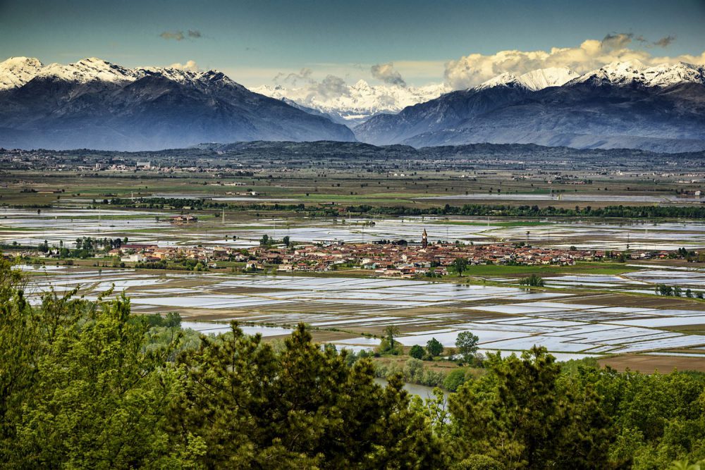
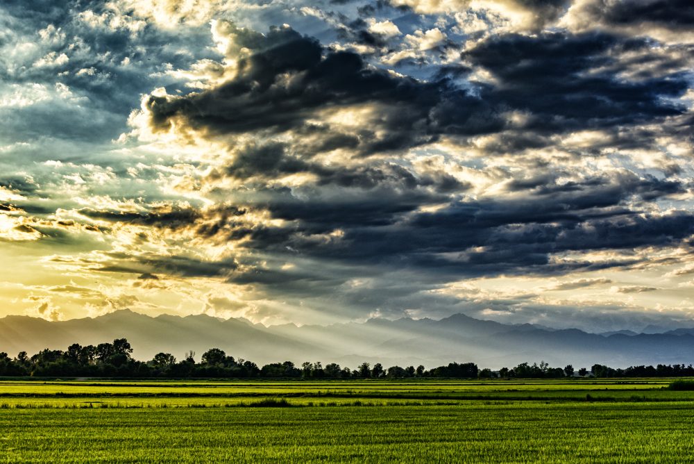
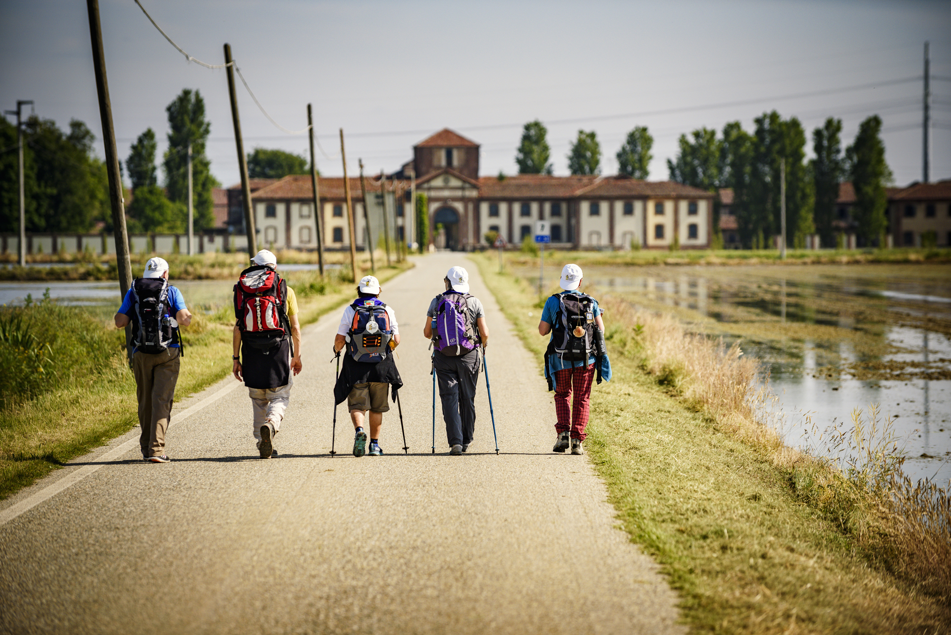
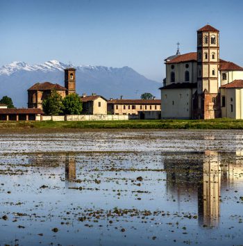
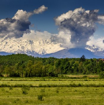
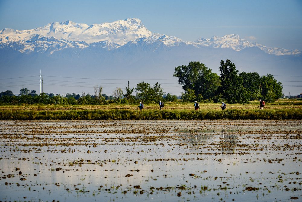
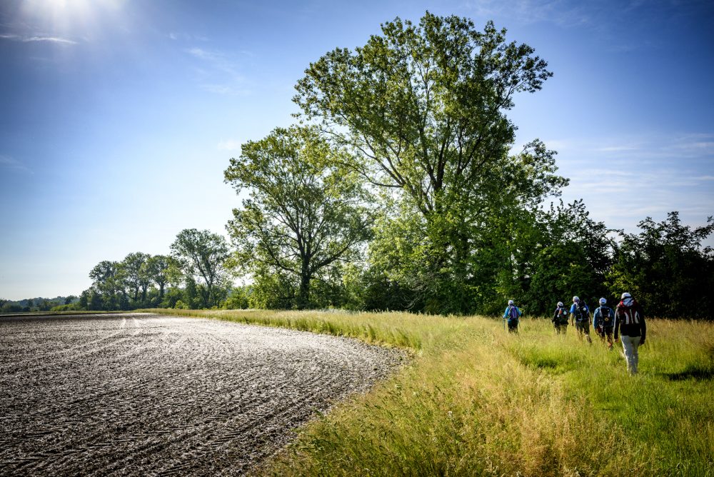
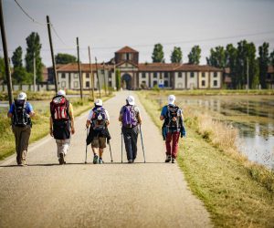
A unique and fascinating environment, the Baraggia, in addition to representing one of the last and most significant examples of prairies in the Po Valley, is a territory strongly linked to the cultivation of rice, which is being produced here since the 17th century. With this itinerary, that crosses the area that extends between Buronzo and Gattinara, you will discover the Vercelli’s Baraggia, where among plateaus, rice fields, and the remnants of the last “Savannah of Italy” surprising treasures are hidden.
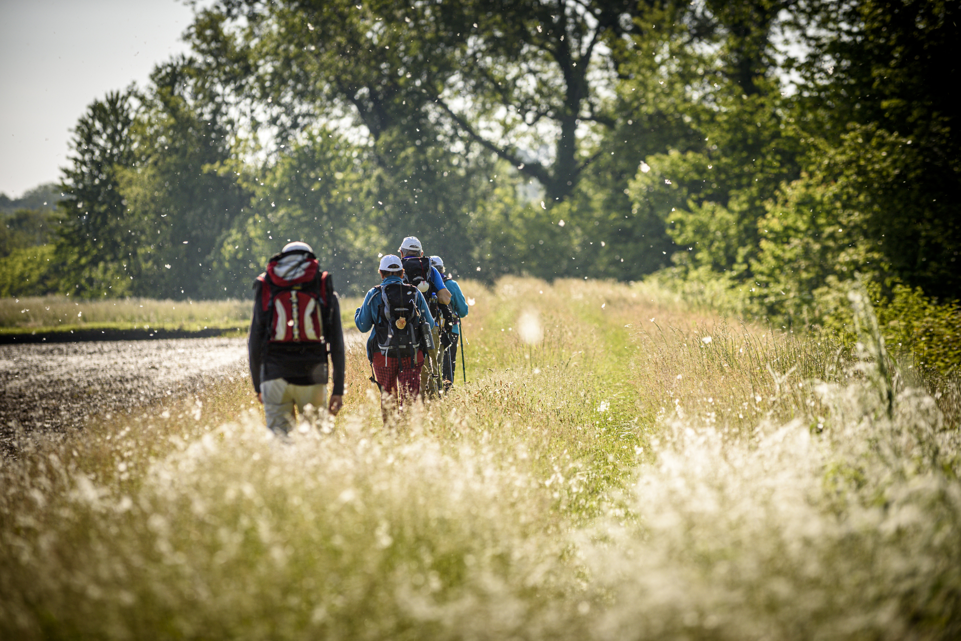
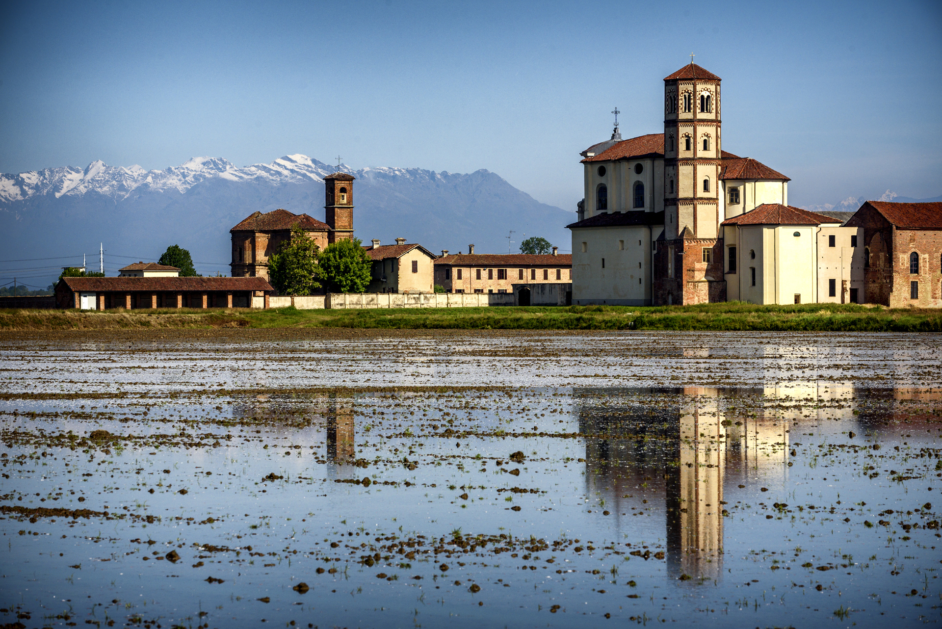
1 BARAGGe nature reservE
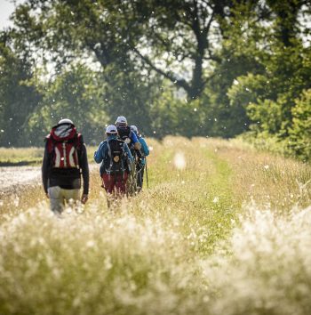
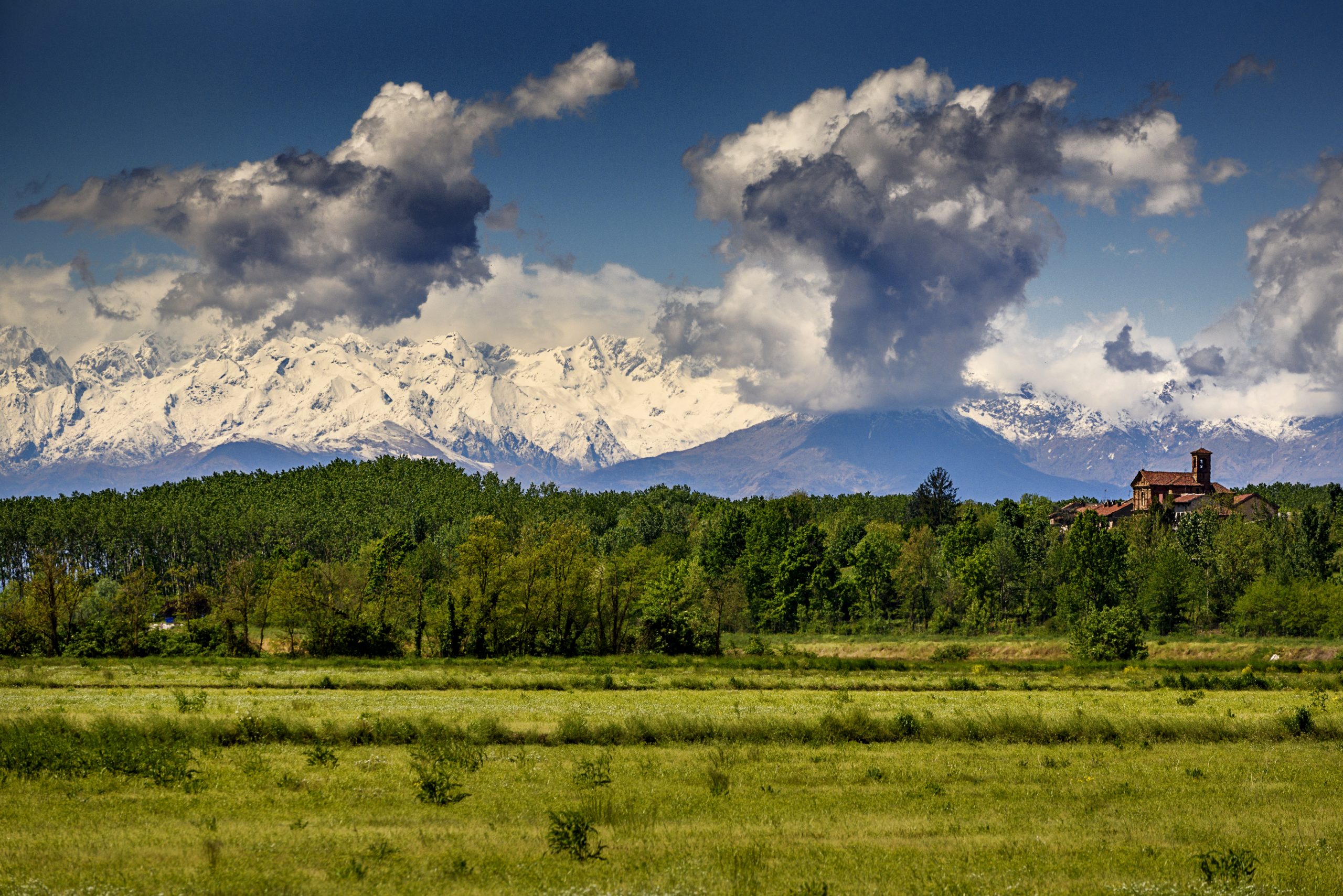
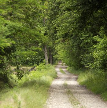
Created to safeguard the last strips of intact Baraggia, the Baragge Nature Reserve aims to protect and conserve this particular environment, which at times resembles the African Savannah. The reserve is made up of six distinct portions of land, which in the Vercelli area are located between Rovasenda, Roasio, Gattinara and Lenta. Very interesting from a landscape point of view, especially in autumn and summer when it offers spectacular views, the Baraggia is an ideal destination for hiking and nature enthusiasts.
2 bURONZO
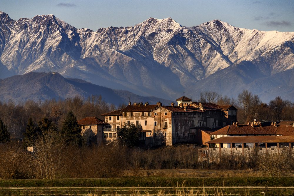
The capital of Baraggia is the small and charming village of Buronzo that preserves a unique fortified complex: the consortium. Consisting of seven castles, the old town appears almost like a scenic space, with many charming views, overlooked by buildings that preserve elements of different eras, such as medieval slits, 18th century facades, and colorful mosaics. Not to be missed, going up along the fascinating via Castello, the enchanting view of the rice fields below and the Monte Rosa mountain range.
3 ROVASENDA
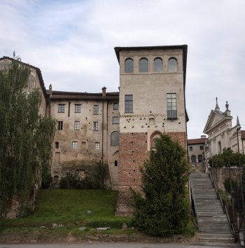
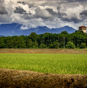
Located in the center of Baraggia, the small agricultural village of Rovasenda hosts a beautiful medieval castle dating back to 1170, with an enchanting 48 meters high tower, one of the most fascinating and best-preserved in the Vercelli area. A few hundred meters away from the ancient Castle is located the new Castle of Rovasenda. The castleremarkably similar to the pre-existing one, was built at the beginning of the 20th century and was commissioned by Count Luigi di Rovasenda, who decided to build one for himself since he was unable to inherit the original Castle.
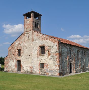
4 LENTA
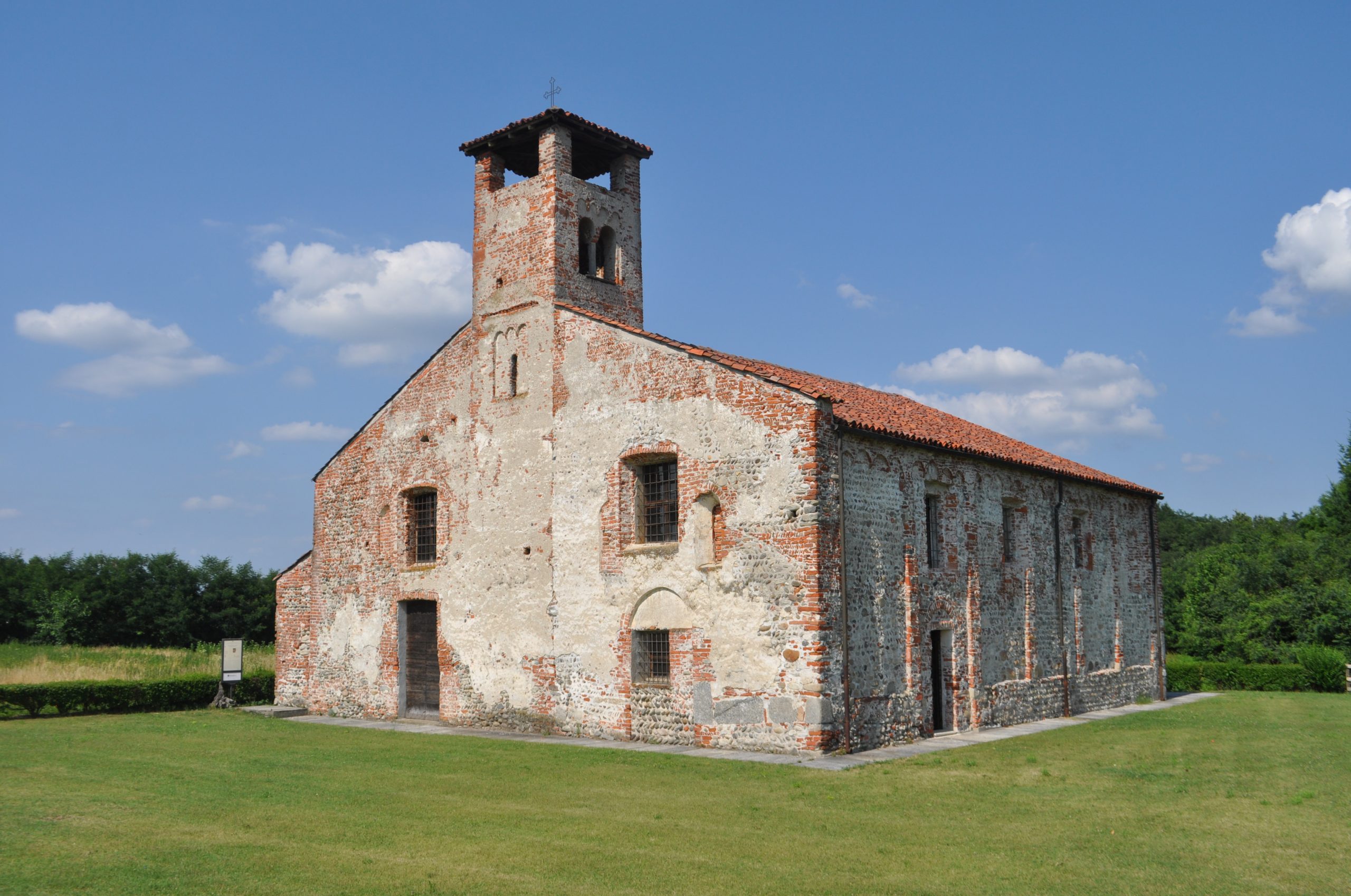
Near to Rovasenda you can visit Lenta, a small agricultural village remarkably interesting from a historical, archaeological, and architectural point of view. The urban plan, halfway between a “ricetto” (fortified refuge) and a castle, defines the village as a “religious fortified refuge” of sorts. Sites not to be missed: the castle and the ruins of the ancient Fortified Refuge (Ricetto); the Parish of Sant’Olimpio, boasting the beautiful crypt of San Biagio; the Parish Church of Santo Stefano, founded in the 5th century and rich in frescoes.
Riserva Orientata delle Baragge
Buronzo
Rovasenda
Lenta
Riserva Orientata delle Baragge
Buronzo
Rovasenda
Lenta
how to get to THE Baraggia
BY CAR
From Vercelli: take the SP 230 towards Biella. At the Crocicchio crossroads, turn right onto the SP3 towards Buronzo.
From Milano and Torino: take the highway A4 and exit at the tollbooth of Balocco. Take the SP 6 towards Buronzo.
BY BUS
Daily bus services link Vercelli to Buronzo, Rovasenda e Lenta.
Deepening
Baraggia RICE PDO
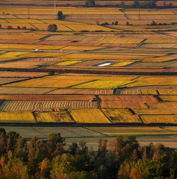
In the lands of Baraggia, the special environmental characteristics and the centuries-long work of cultivation selection and experimentation by the area’s rice growers have allowed for an improvement in the quality of the rice produced, against a lower yield. Only in this way was it possible to obtain the first and only rice PDO in Italy in 2007: Baraggia Biellese e Vercellese rice.
As indicated in the production regulations, there are 28 municipalities that make up the delimited area for the production of the PDO located in the provinces of Biella and Vercelli.
There are seven varieties of rice recognised in the PDO: Arborio, Baldo, Balilla, Carnaroli, S. Andrea Loto and Gladio. From a dietary point of view, Baraggia rice is distinguished by its greater resistance to cooking and its marked ability to absorb flavours and seasonings.
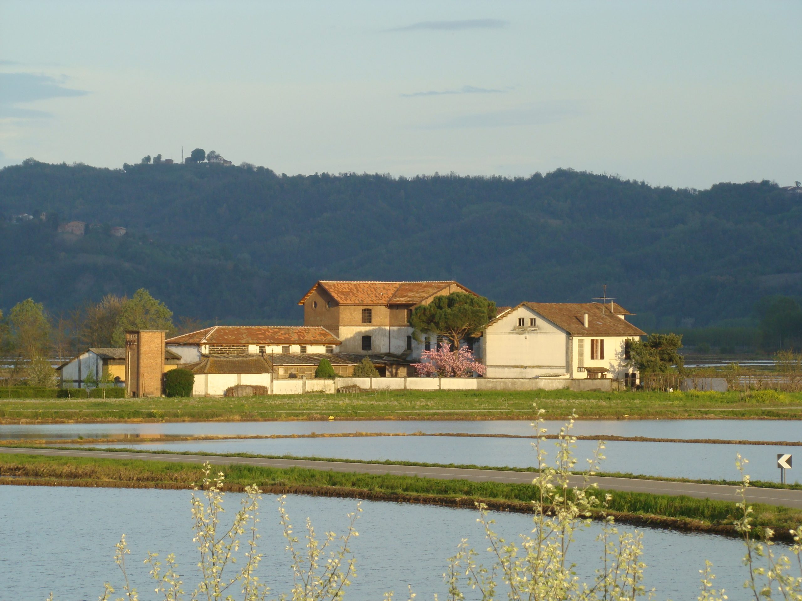
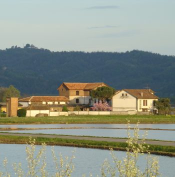
Don’t miss the chance to visit one of the many farms that produce this rice excellence.
Plan your holiday
Where to eat, where to sleep, how to get around: plan your trip to Valsesia and Vercelli!
Richiedi
informazioni
su questo
itinerario
Compila il form per saperne di più su questo itinerario
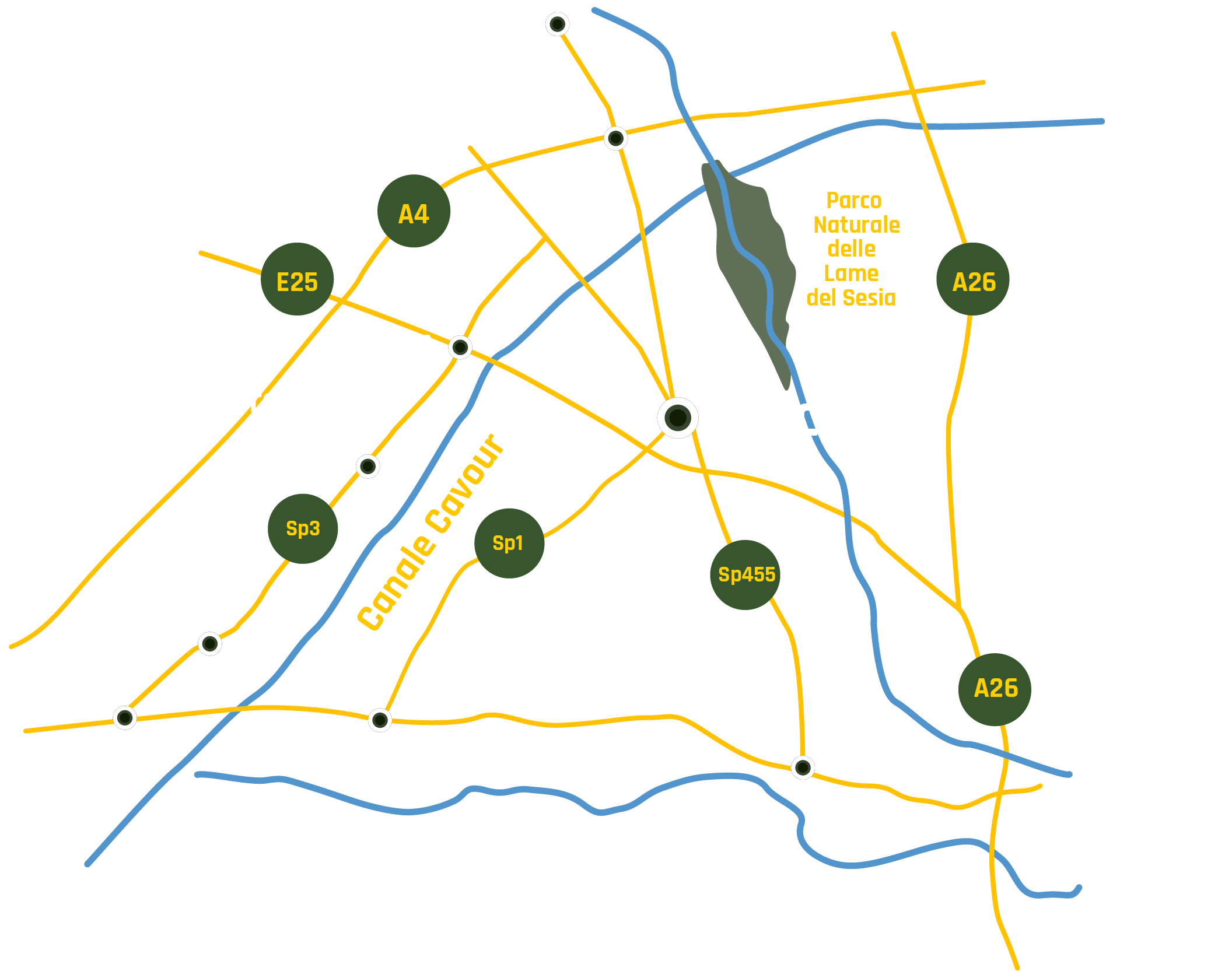
Exploring the Canale Cavour
Itinerary The lands of rice
aLONG THE WATERS OF THE vercellI AREA
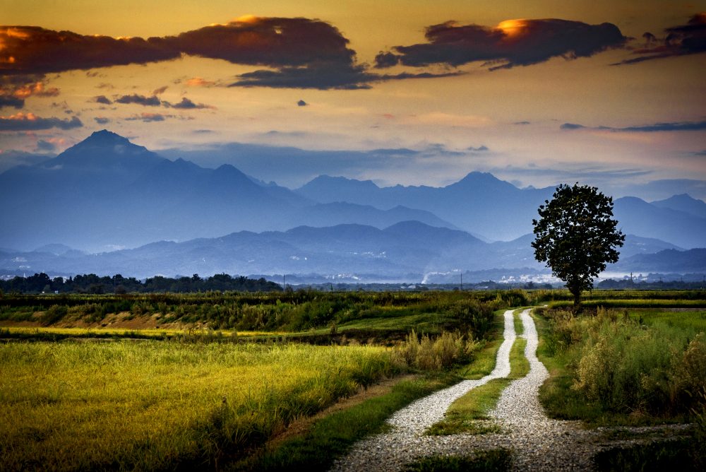
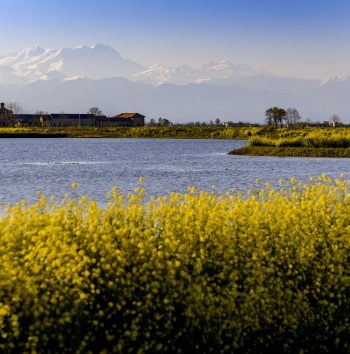
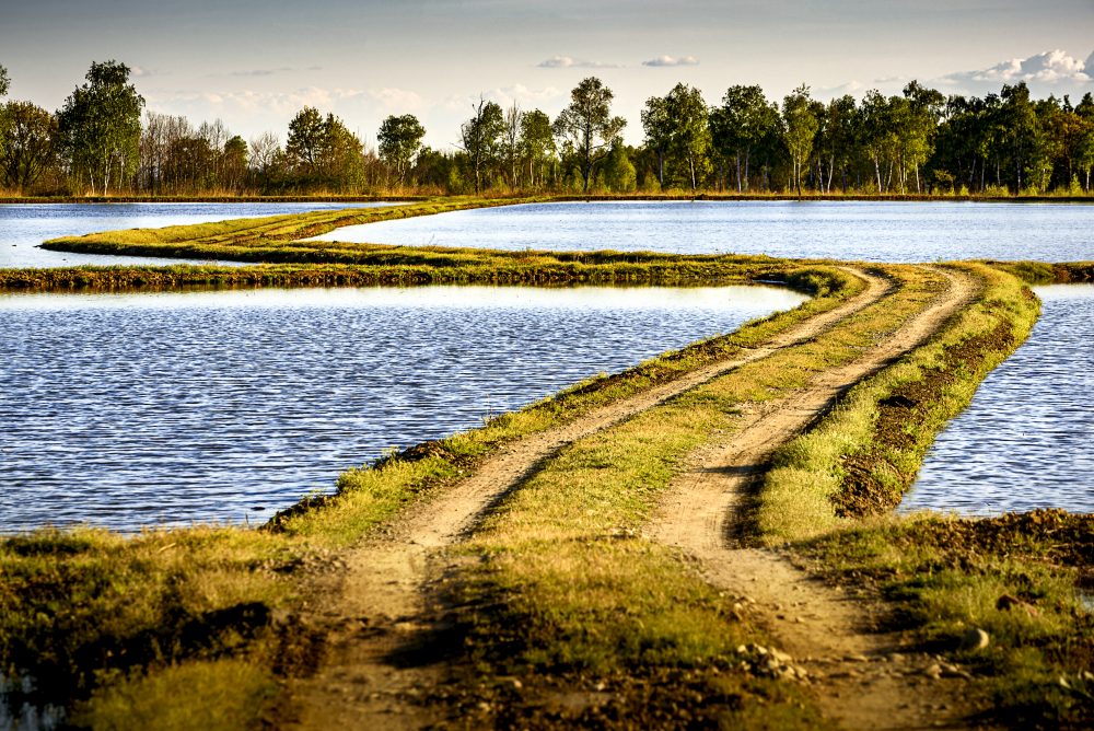
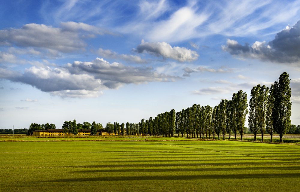
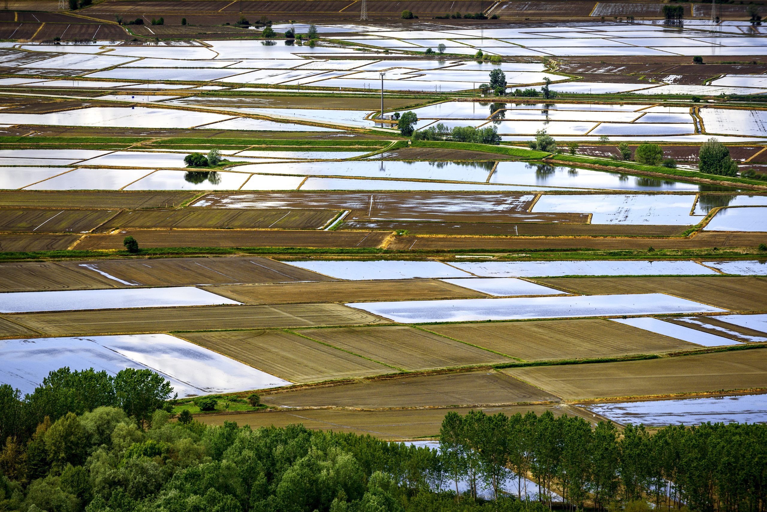
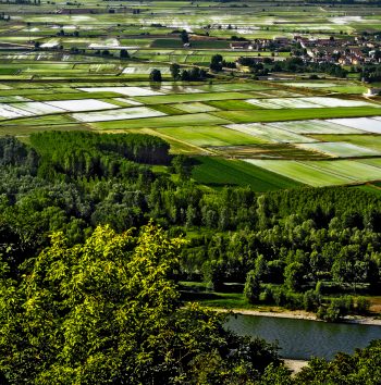
The rice-growing landscape of Vercelli is marked by a network of canals and extraordinary hydraulic engineering works that irrigate the rice paddies: this complex water management is the basis of rice cultivation. With this itinerary that crosses the entire Vercelli plain, from the Dora Baltea River to the Sesia River, you will discover the Canale Cavour and the majestic hydraulic works of the Vercelli irrigation system.
1 The Canale Cavour and the Vercelli irrigation network
Almost 85 km long, the Canale Cavour is a fantastic example of hydraulic engineering work that connect the Po River in Chivasso to the Ticino River in Galliate. Strongly wanted by Camillo Benso Conte di Cavour, this colossal work represents, together with other canals such as the Naviglio d’Ivrea and the De Pretis Canal, the backbone of an extensive and efficient irrigation network that crosses the entire Vercelli plain, and thanks to which it has been possible, over the centuries, to grow rice.
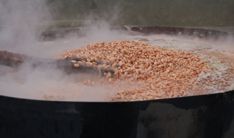
2 sALUGGIA
The small town of Saluggia, which rises on a steep embankment on the left of the Dora Baltea, is known above all for its beans, much sought after for the traditional Vercelli “panissa” dish. Near the village you can admire the intake of the Canale Farini, a little jewel of engineering and hydraulic architecture of the 19th century.
3 LIVORNO FERRARIS
Livorno Ferraris is known as the birthplace of Galileo Ferraris, an illustrious physicist and engineer of the 19th century. Do not miss, in the charming historical center of the village, the Ferraris Civic Museum, dedicated to the scientist and his brother Adamo, Garibaldi’s personal doctor. Near the village you can see the Canale De Pretis, an ancient canal of the 18th century.p
4 Tenuta Colombara – Conservatorio della risicultura
In the middle of Vercelli’s rice fields, the fascinating Tenuta Colombara hosts the Conservatory of Rice Cultivation. In the estate, a beautiful example of a farmhouse with an inner courtyard, there are areas in which some of the representative settings of the history and life of the rice-growing have been reconstructed: artisan workshops, houses, the school and the beautiful dormitory of the rice-weeders. This is indeed worth a visit.
5 Santhià
The city of Santhià, where the oldest historical carnival of Piedmont takes place, is crossed by the Via Francigena, of which it is the 44th stop. Not far from the city center, along the Naviglio d’Ivrea, is located the Experimental Hydrometric Station of Santhià, a beautiful building of the 19th century, one-of-a-kind and built to measure the flow and distribution of water of the complex Vercelli irrigation network.
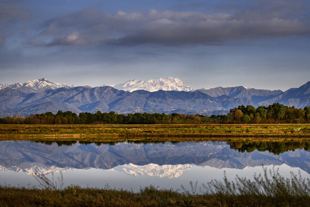
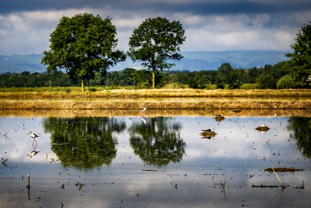
6 LAME DEL SESIA nature park
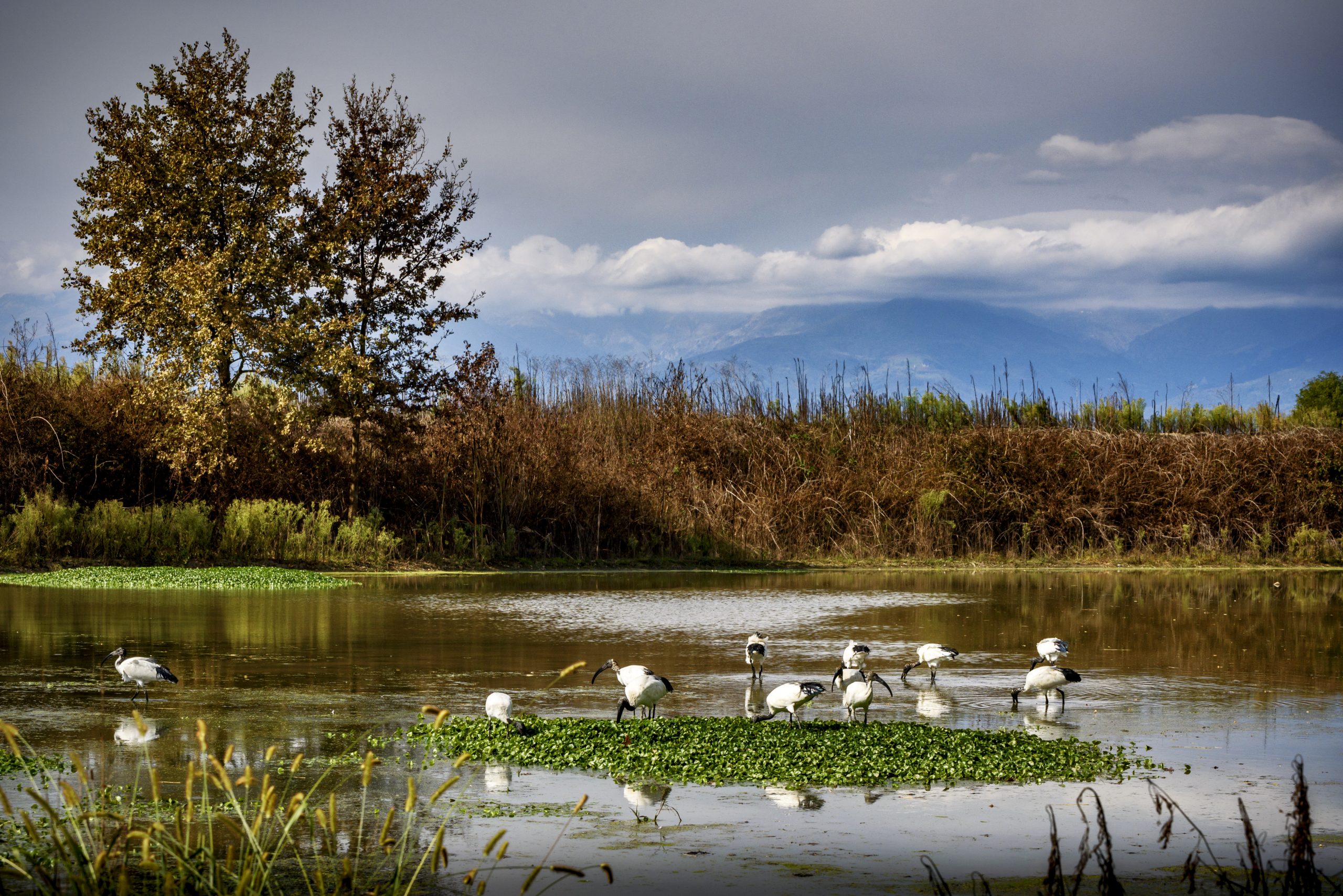
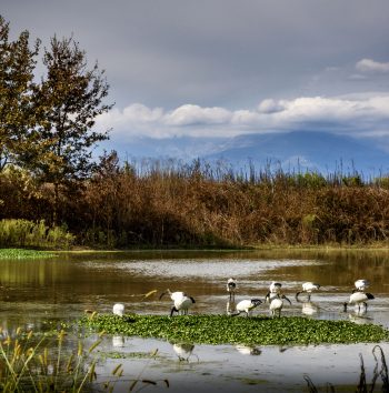
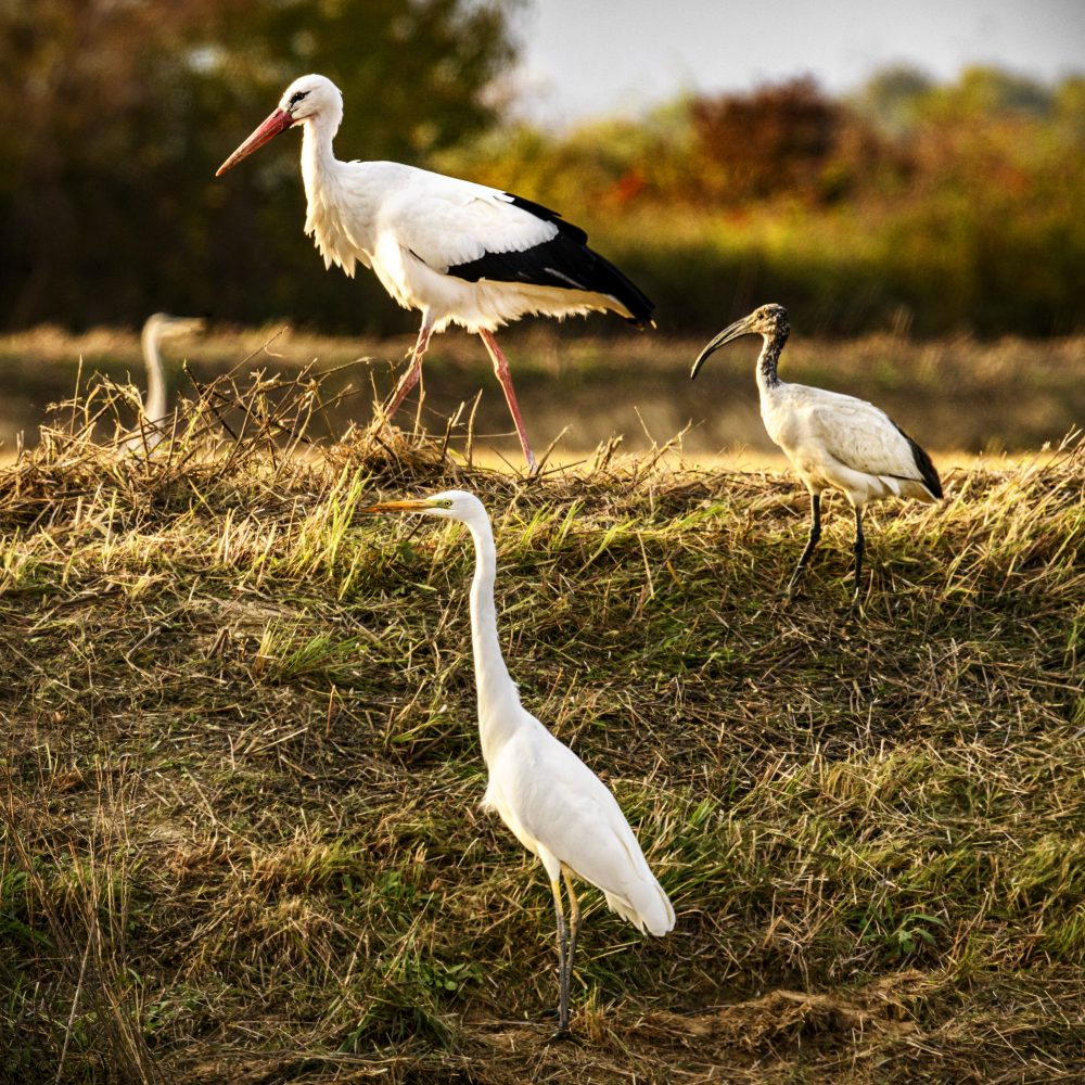
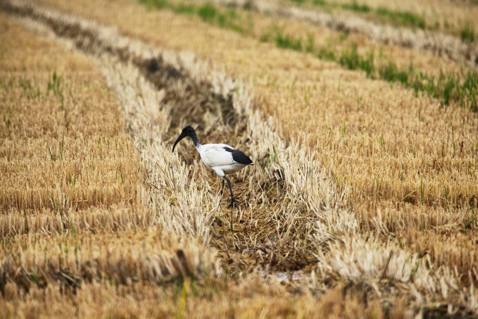
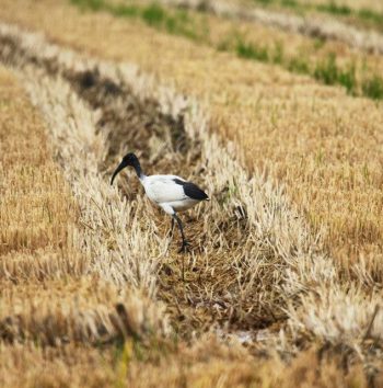
The nature park, located along the right bank of the Sesia River, is a protected oasis of 900 hectares water pools, water sheets, and woods and natural habitat of rich fauna and lush vegetation. Several routes start from Albano Vercellese that will allow you to discover one of the most important ornithological oasis in Italy and Europe.
Il canale Cavour e la rete irrigua Vercellese
Saluggia
Livorno Ferraris
Tenuta Colombara – Conservatorio della Risicultura
Santhià
Parco naturale delle Lame del Sesia
Il canale Cavour e la rete irrigua Vercellese
Saluggia
Livorno Ferraris
Tenuta Colombara – Conservatorio della Risicultura
Santhià
Parco naturale delle Lame del Sesia
How to get to the canale Cavour
From Vercelli: take the SP1 “Strada delle Grange” towards Crescentino. From Crescentino take the SP37 towards Saluggia.
From Milano and Torino: take the highway E25 and exit at the tollbooth of Vercelli Ovest. take the SP1 “Strada delle Grange” towards Crescentino. From Crescentino take the SP37 towards Saluggia.
BY TRAIN
Saluggia, Livorno Ferraris e Santhià are located on the Milan-Turin railway line.
Canale Cavour
#losapevateche
Deepening
Canale Cavour
The Canale Cavour is to be considered an extraordinary work not only on an engineering level, given its size and water flow, but also on an architectural level, as along its 85 km route there are 101 bridges, 210 siphons and 62 canal-bridges.
The most striking points to observe are those where the Canale Cavour crosses a watercourse (river or stream) by means of a canal bridge or siphon.
Among the most spectacular canal bridges, i.e. those in which the canal crosses the river/stream by means of a bridge, are over the Dora Baltea near Saluggia and over the Cervo stream near Formigliana.
Equally spectacular are the siphon tombs, i.e. points where the canal passes under a river/stream, such as the siphon tomb on the Elvo stream near Vettignè and the one on the Sesia river near Greggio.
In Chivasso is the monumental Canale Cavour Intake Building. The Intake Building is 40 metres long and has two floors with 21 lights consisting of three orders of sluice gates.
Plan your holiday
Where to eat, where to sleep, how to get around: plan your trip to Valsesia and Vercelli!
Richiedi
informazioni
su questo
itinerario
Compila il form per saperne di più su questo itinerario
Exploring the Po river
Itinerary The lands of rice
nature and rice fields
just a stone’s throw away from Monferrato
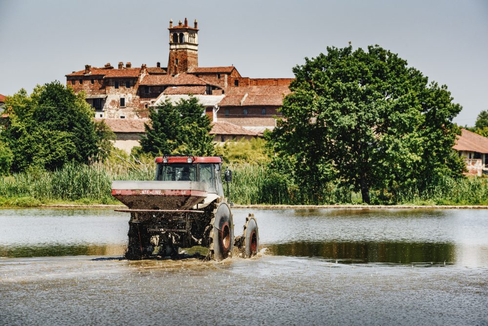
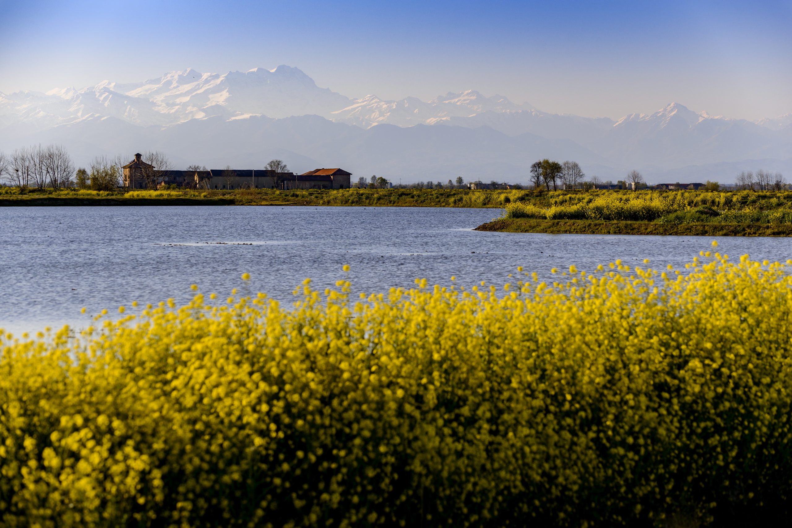
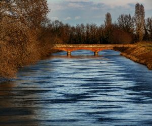
In a predominantly agricultural area with many villages, the short stretch of the Po River near Vercelli separates the plain of rice fields from the green hills of Monferrato. With this itinerary, you can discover the charming area between Trino and Crescentino, where the largest Italian river flows in territories different in terms of environment, history and traditions, but linked since ancient times.
1 the po river and the nature park
The Po Nature Park was created with the aim of safeguarding the river’s last natural environments. The protected areas, in the stretch between Crescentino and Trino, are particularly interesting for birdwatchers, who can admire numerous colonies of resident birds. Near the river and within the protected areas, there are several marked paths, huts, and rest points to enjoy nature in full relaxation.
2 crescentino
Crescentino, located at the confluence of the Po River and the Dora Baltea River, in the Middle Ages was an important “free commune”. Downtown, where the medieval urban plan is still preserved, you can trace the symbol of the town: the Civic Tower, dating back to the 14th century, it houses the largest bell in the province of Vercelli known as the “Crescentina”. Also the Isola S. Maria Nature Reserve, one of the protected areas of the Po Nature Park, is located not far from town.
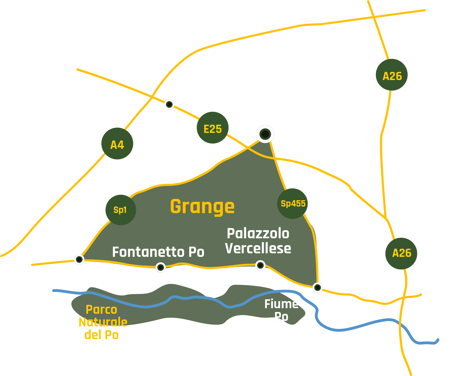
3 fontanetto po
Fontanetto Po, that took its name from the numerous fountains across its area, is known as the birthplace of Giovan Battista Viotti, one of the greatest musicians of the 18th century.Remarkably interesting along via Viotti,where the artist was born, is the Parish Church of S. Martino with its sumptuous bell tower in Romanesque-Norman style. It is 56 meters high.
4 Antico Mulino – Riseria “S.Giovanni”
Near Fontanetto Po, you can find the Mulino – Riseria S. Giovanni, the only surviving example in the Province of Vercelli of a rice mill powered by water. The rice mill, which preserves the old machinery for processing rice, is part of the Terre d’Acqua Ecomuseum.
5 Palazzolo Vercellese
The small agricultural village of Palazzolo Vercellese was founded by Romans along the Ticinum-Augusta-Taurinorum Road, which, passing along the Po River, connected Turin to Pavia. From the village, looking at the hills of Monferrato, it is possible to admire the beautiful ravines and the very steep walls created by rainwater.
4 Trino
Trino, located at the foot of the hills of Monferrato, was within the feud owned by the Paleologis, a noble family that ruled the fate of the Marquisate of Monferrato from 1305 until 1532. There are many artistic and architectural jewels here: Palazzo Paleologo hosted the court of the Paleologis; the Church of San Bartolomeo was built in the Middle Ages; the “G.A. Irico” Civic Museum hosts several local finds.
Il fiume Po e il parco
Crescentino
Fontanetto Po
Antico Mulino – Riseria “S.Giovanni”
Palazzolo Vercellese
Trino
Il fiume Po e il parco
Crescentino
Fontanetto Po
Antico Mulino – Riseria “S.Giovanni”
Palazzolo Vercellese
Trino
how to get the po river
BY CAR
From Vercelli: take the SP1 “Strada delle Grange” towards Crescentino.
From Milano and Torino: take the highway E25 and exit at the tollbooth of Vercelli Ovest. Take the SP1 “Strada delle Grange” towards Crescentino.
BY BUS
Daily bus services link Vercelli to Crescentino, Fontanetto Po, Palazzolo Vercellese e Trino. How to get to Vercelli area.
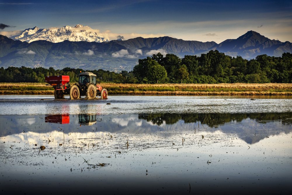
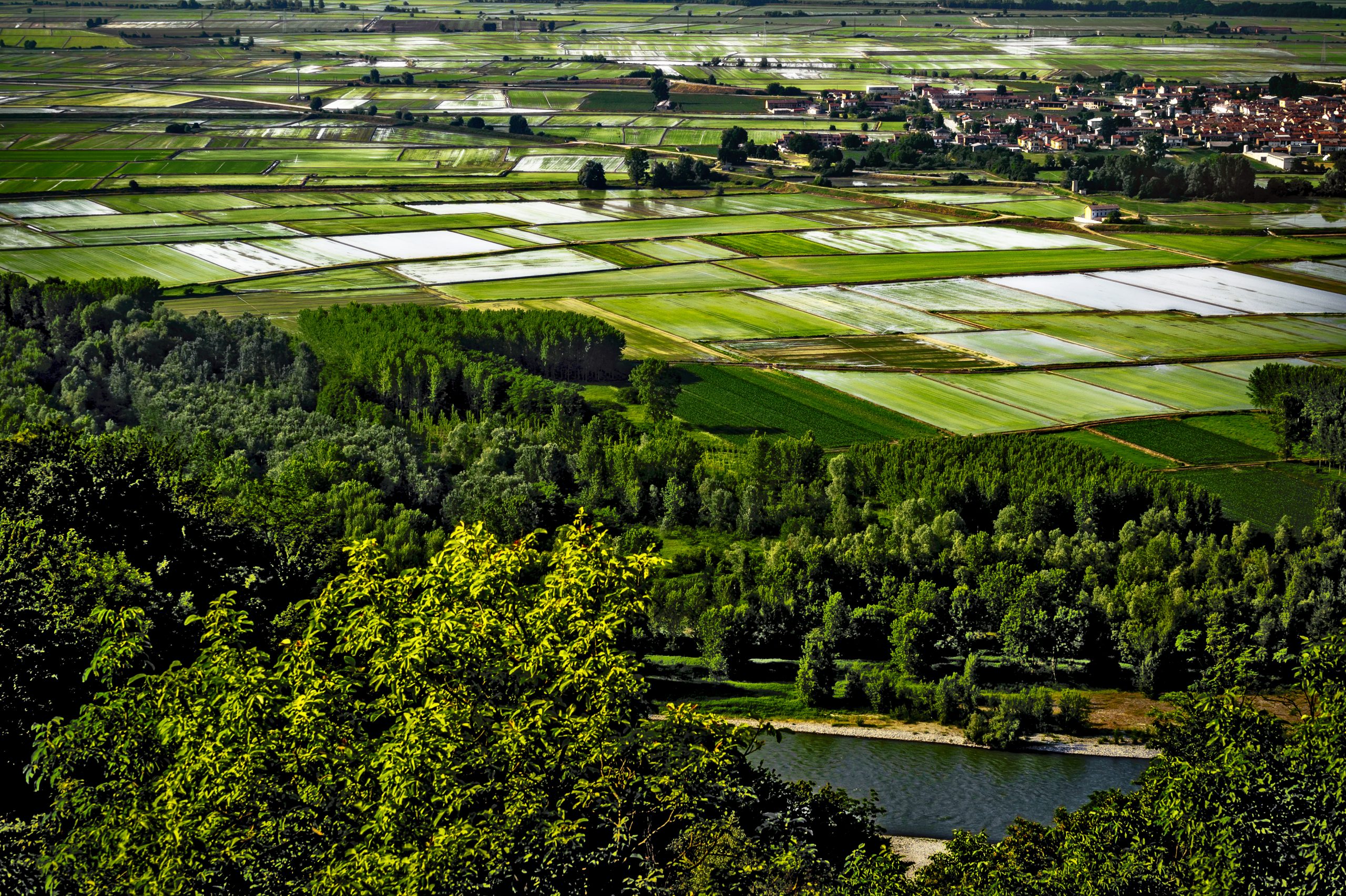
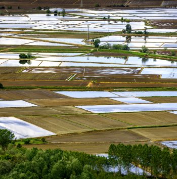
Checkered sea
#losapevateche
Deepening
Checkered sea
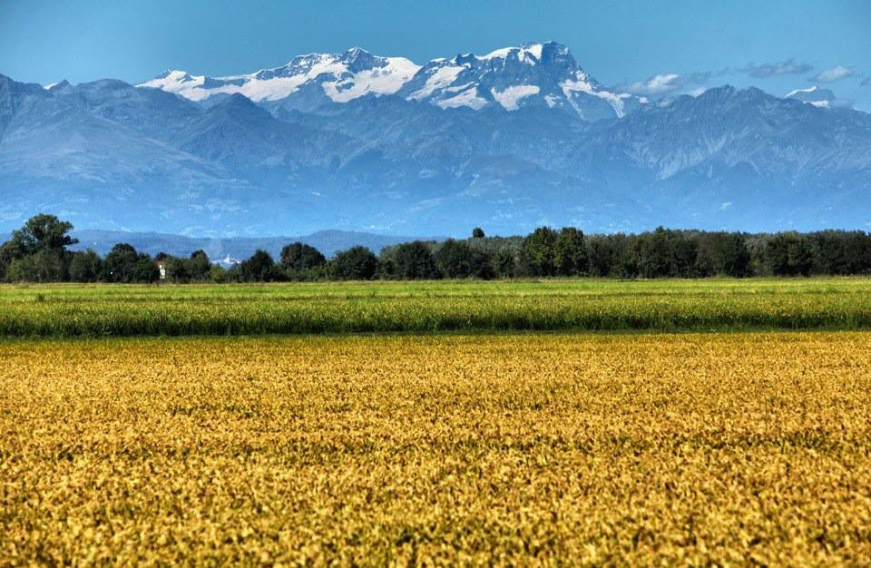
Heading towards the hills of lower Monferrato, it’s possible to travel a beautiful scenic route that, in many places, allow you to enjoy wonderful views of the Po River and the Vercelli rice plain.
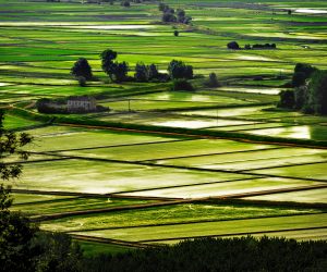
This route is particularly charming in the clear spring days when the flooded rice fields create the spectacular view of the “checkered sea” framed by the Alps and Monte Rosa..
The most suggestive points from where this unique landscape can be admired are at the Rocca di Verrua Savoia, the castle of Gabiano, the parish church of Cantavenna, the small hamlet of Rocca delle Donne and the castle of Camino.
Plan your holiday
Where to eat, where to sleep, how to get around: plan your trip to Valsesia and Vercelli!
Richiedi
informazioni
su questo
itinerario
Compila il form per saperne di più su questo itinerario
Exploring the Grange
Itinerary The lands of rice
Medieval corners among
the rice fields
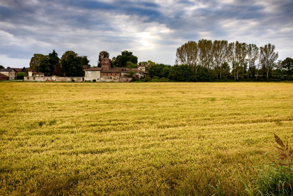
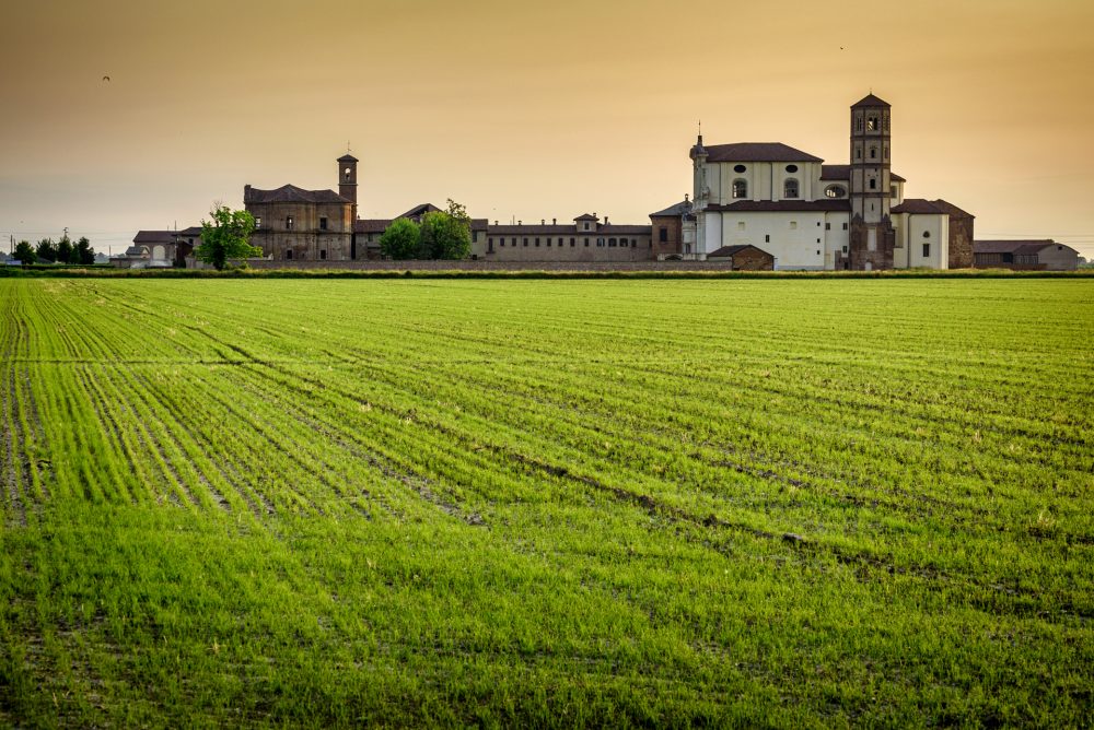
The history of Vercelli’s agriculture and the transformation of the territory from lowland forest to rice-growing land can be found in a small strip of plain, located among Vercelli, Crescentino, and Trino, known as the Triangle of the Grange. Through this itinerary, you may visit the locations that first saw the birth of the cultivation of rice, the Grange, which represents a living example of an environment full of history and art.
1 lucedio abbey
Known as Principato di Lucedio since 1875, the ancient abbey, was founded in 1123 by the Cistercians at the behest of the Marquis of Monferrato, who granted them the rights over various lands. Now the Abbey is a modern farm that can be toured, and that was able to preserve its characteristic medieval environment. After having crossed the fortified walls, it is still possible to admire the Abbey church, the peculiar bell tower, octagonal at the top but square at the base, and the beautiful chapter house.
2 cascina darola
Located due north of Lucedio, this farmhouse boasts ancient origins. Donated in 933 by the kings of Italy Ugo and Lotario to the marquises of Monferrato, the latter sold it to Lucedio in 1123: it thus became one of the six granges owned by the abbey. From a structural point of view, it represents an excellent example of a farmstead with a closed courtyard.
3 Montarolo, Ramezzana, Castelmerlino, Leri e Montarucco
In the past property of Lucedio, the others Grange are located near the rural complex. While Montarucco, Ramezzana and Montarolo are located due south of Lucedio, Leri and Castelmerlino are located in the area that extends to the northwest of the “principato” and correspond to the possessions of the Benso di Cavour family, to whom the minister Camillo Benso Conte di Cavour belonged.
4 “Sorti e della Partecipanza” forest nature park
The last remnants of the ancient lowland forest that extended across the Po Valley, a forest, of very ancient origins and already sacred to the Romans, was preserved thanks to an extremely strict collective management system known as the “Partecipanza” that dates back to the Middle Ages. The forest features several hiking trails and equipped areas where you can enjoy pleasant moments of relaxation.
5 San genuario
TenSan Genuario, an agricultural estate that was in the past the site of an abbey, is the most ancient Benedictine monastic settlement inside the forest of Lucedio. Do not miss the Castle dating back to the 14th century, which has a magnificent circular tower surrounded by a fortress and the San Genuario Nature Reserve, which preserves an important system of wetlands fed by springs and fountains.
6 madonna delle vignE SANCTUARY
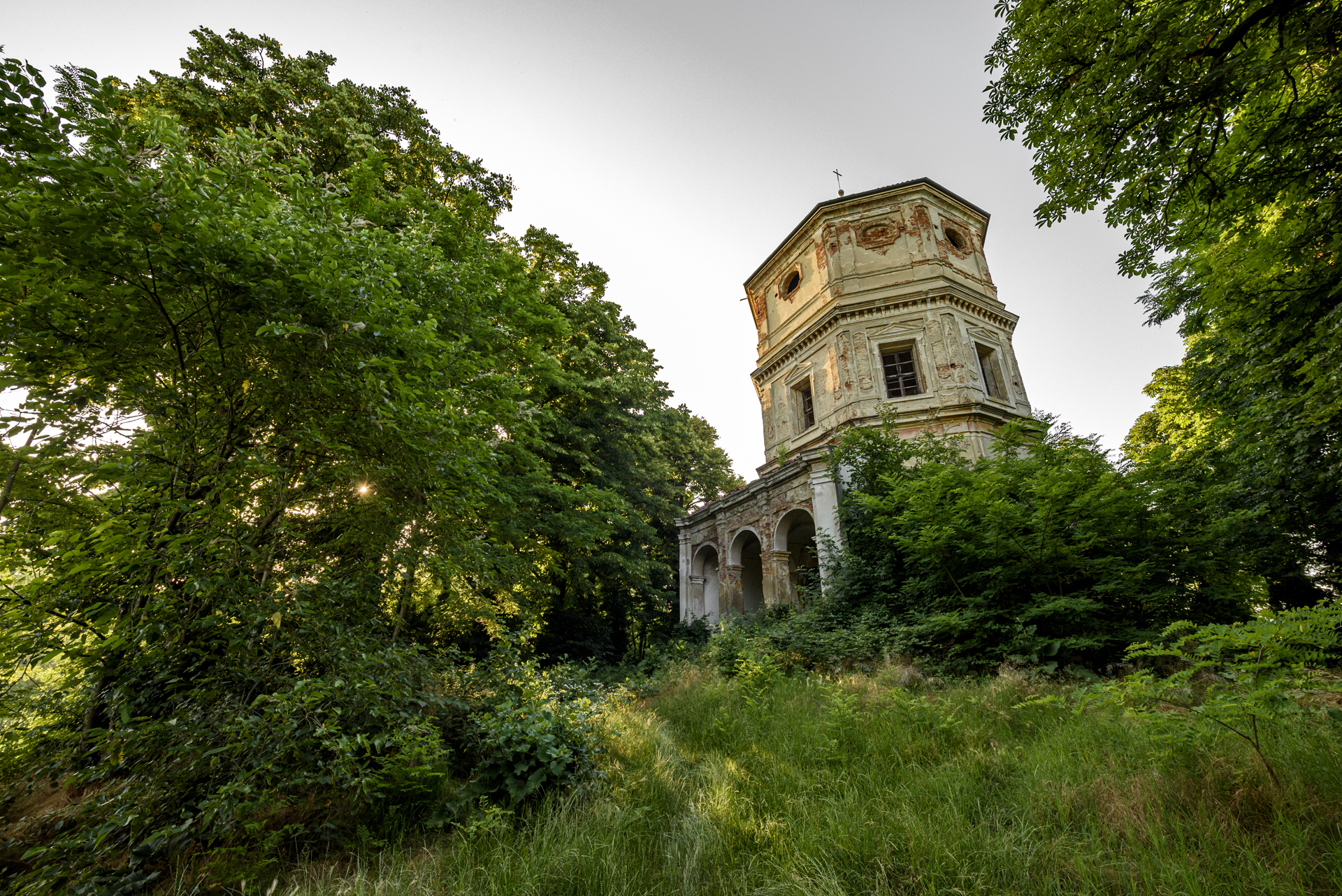
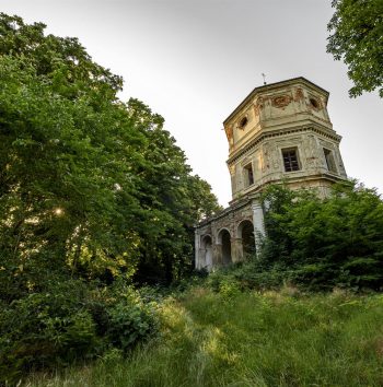
The Sanctuary, abandoned for many years, is located on the hill leading to Montarolo and is a fine example of Piedmontese Baroque architecture and a place that has inspired many legends and mysteries. The most famous is the “Spartito del Diavolo” (“Devil’s score”), a palindrome song considered magical and supposedly able to free a demon held prisoner in the Abbey of Lucedio.
L’Abbazia di Lucedio
Cascina Darola
Montarolo, Ramezzana, Castelmerlino, Leri e Montarucco
Montarolo, Ramezzana, Castelmerlino, Leri e Montarucco
Montarolo, Ramezzana, Castelmerlino, Leri e Montarucco
Montarolo, Ramezzana, Castelmerlino, Leri e Montarucco
Bosco delle Sorti della Partecipanza di Trino
San Genuario
Santuario Madonna delle Vigne
L’Abbazia di Lucedio
Cascina Darola
Montarolo, Ramezzana, Castelmerlino, Leri e Montarucco
Montarolo, Ramezzana, Castelmerlino, Leri e Montarucco
Montarolo, Ramezzana, Castelmerlino, Leri e Montarucco
Montarolo, Ramezzana, Castelmerlino, Leri e Montarucco
Montarolo, Ramezzana, Castelmerlino, Leri e Montarucco
Bosco delle Sorti della Partecipanza di Trino
San Genuario
Santuario Madonna delle Vigne
How to get to the Grange
BY CAR
From Vercelli: take the SP1 “Strada delle Grange” towards Crescentino. Turn on SP 34 towards Lucedio.
From Milano and Torino: take the highway E25 and exit at the tollbooth of Vercelli Ovest. Take the SP1 “Strada delle Grange” towards Crescentino. Turn on SP 34 towards Lucedio.
Meaning of “Grange”
#losapevateche
Deepening
THE Grange
The Grange, literally “granaries”, were ancient residential units and agricultural centers where the lay brothers, or Cistercian monks not part of the convent, carried out land reclamation works on an area covered by lowland forests to make it suitable for agricultural use.
The Grange represented a decisive instrument in the process of transforming an uncultivated area into arable land: when a landowner wished to transform his possessions in order to make them productive, the abbots sent their own monk, the “granciere”, who directed the reclamation work.
It is therefore undeniable that the activity carried out by the monks in the Vercelli area was a determining factor in the birth and taking root over the centuries of an agricultural and rice-growing vocation: it was in fact the Cistercians who introduced rice cultivation in the 15th century.
Plan your holiday
Where to eat, where to sleep, how to get around: plan your trip to Valsesia and Vercelli!


