ALAGNA – Capanna Giovanni Gnifetti
Route / Trekking
Hikes
trail n. 205 Alagna – Capanna Giovanni Gnifetti
Difficulty: difficult
average duration: 7 hours
departure altitude: 1191 mt
arrival altitude: 3647 mt
altitude difference: 2456 mt
Route description
In the past it was one of the most frequented routes: in fact, it was the most convenient pass from Alagna to Gressoney and the route to Col d’Olen. Nowadays, to take one quickly to higher altitudes one preferably uses the ski lifts: from Alagna one takes the cable car to Pianalunga, then the Funifor that leads to Passo dei Salati, and one can push on to the edge of the glaciers with the Punta Indren station (3,275 meters above sea level) for alpine ascents.
Wanting instead to walk the entire itinerary, from the center of the village of Alagna, go up to the cableway departure station where the path on the right begins, leading to the hamlets of Dosso (Fum Diss) and Piane (Fum d’Boudma). After crossing the hamlet, follow a section of unpaved road and then follow the path that crosses the Olen stream over a bridge. You return to the road and then take the mule track to the left that crosses the ski slope and climbs into the woods.
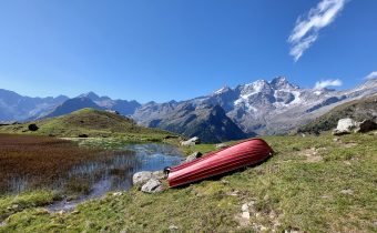
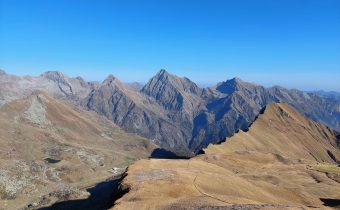
You leave the woods near Zar Oltu and pass the Oltu Alp, from which you reach the slope and soon afterwards arrive at Zam Seiwji and Undre Seiwji, picturesque places with green and scenic plateaus on which a number of alpine pastures and refuges lie. Continue on the trail beside the hut and you will reach Alpe Pianalunga, 2025m (about 1h45). Continue in sections along the ski slope, in sections on the trail, and after a short ascent you reach the Fontanone plateau. From here the trail continues past a large split boulder in the middle, Sasso del Diavolo (Der Prebet stein), 2418m.
Continue along the mule track that faces the steep slope and reach the junction with trail 205d, which to the left leads shortly to Col d’Olen, 2881m.
Immediately afterwards you approach the square where the historic Albergo Guglielmina, destroyed by fire, used to be, and then the Rifugio Città di Vigevano, 2864m (about 4 hours). you then reach the small chapel dedicated to the Vergine del Rosa and continue, leaving the refuge to the right.
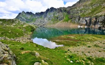
You pass by a small lake and return to the ski slope near the A.Mosso International Scientific Institute, an historical research center at 2,901 meters above sea level. You then reach Passo dei Salati, 2936m (in about 5 hours total), the arrival point of the cable car stations from Alagna and Gressoney. Not far away there is the departure station for the Indren cable car. A good, wide path leads up to the Stolemberg, 3202m. About a hundred meters from the summit, bend left on the Aosta Valley side and descend to the Upper Pisse Pass, 3112m, with a few sections equipped with fixed ropes. The trail climbs to the ridge and leads to Colletto dell’Acqua, about 3200m, from where with a short climb you reach the old Punta Indren station, 3254m. A traverse to the northwest takes you to the new cable car station at 3275m.
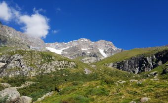
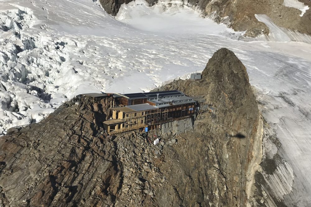
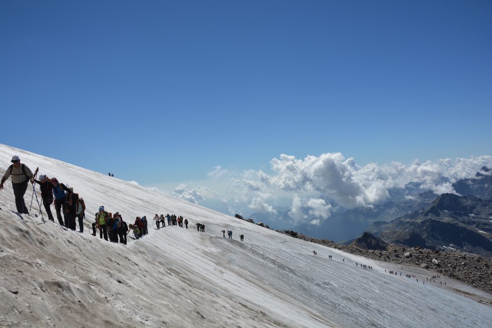
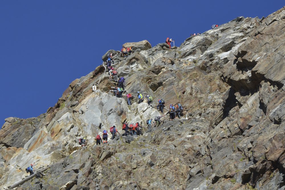
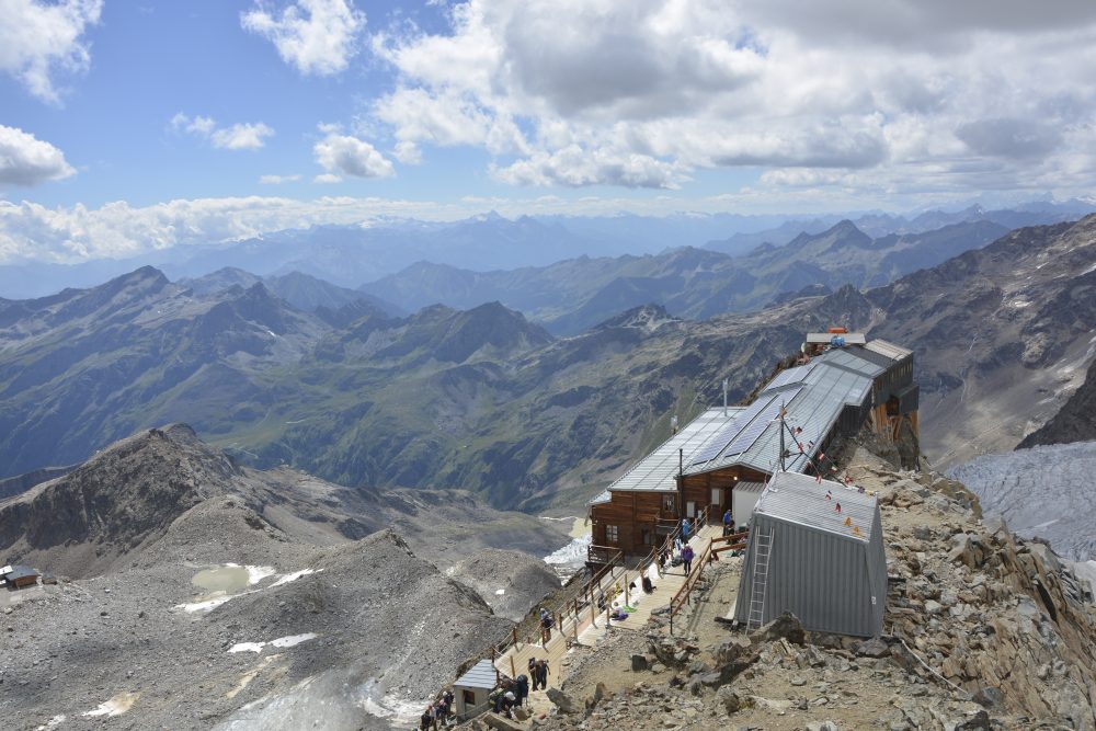
From here the itinerary becomes mountaineering; it is necessary to cross the Indren Glacier with some crevasses, overcome rocky edges with sections equipped with ladders and cables to reach the Giovanni Gnifetti Hut, 3647m (total about 7h), flanked by the little church of the Madonna dei Ghiacciai.
Several traverses and numerous ascents can be made from the Gnifetti Hut: Pyramid Vincent, 4215m, Balmenhorn, 4167m (with the hut of the same name and the statue of Christ of the Summits), Black Horn, 4322m, East Lyskamm, 4527m, Parrot Peak, 4436m, Punta Gnifetti (Signal Kuppe), 4554m, Punta Dufour, 4634m.
On Punta Gnifetti rises the Regina Margherita hut. 4554m, the highest refuge in Europe.
Other routes
recommended
Valsesia has a lot to offer to hiking enthusiasts
Suggestive trails surrounded by nature that offer breathtaking views: be surprised by the beautiful mountains of Valsesia!