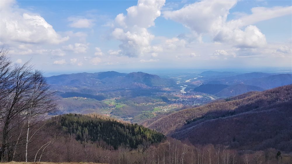
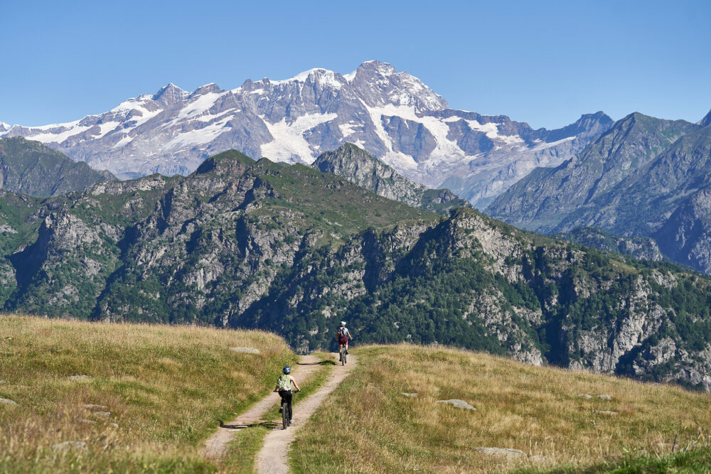
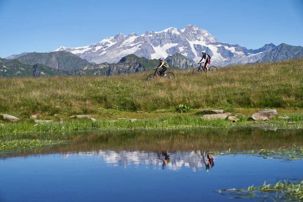
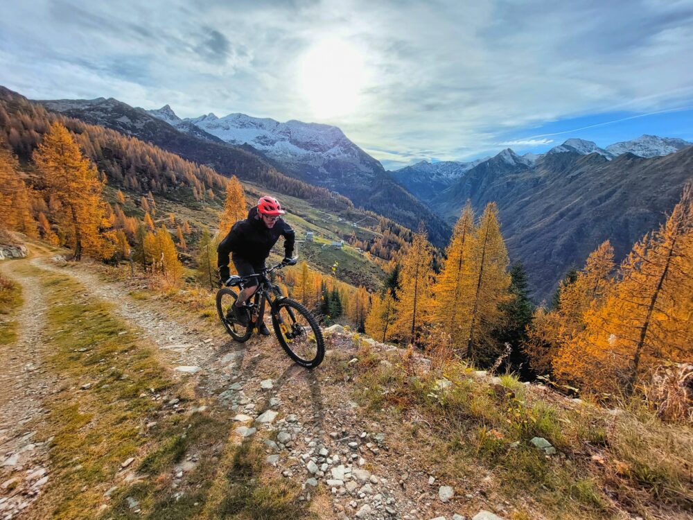
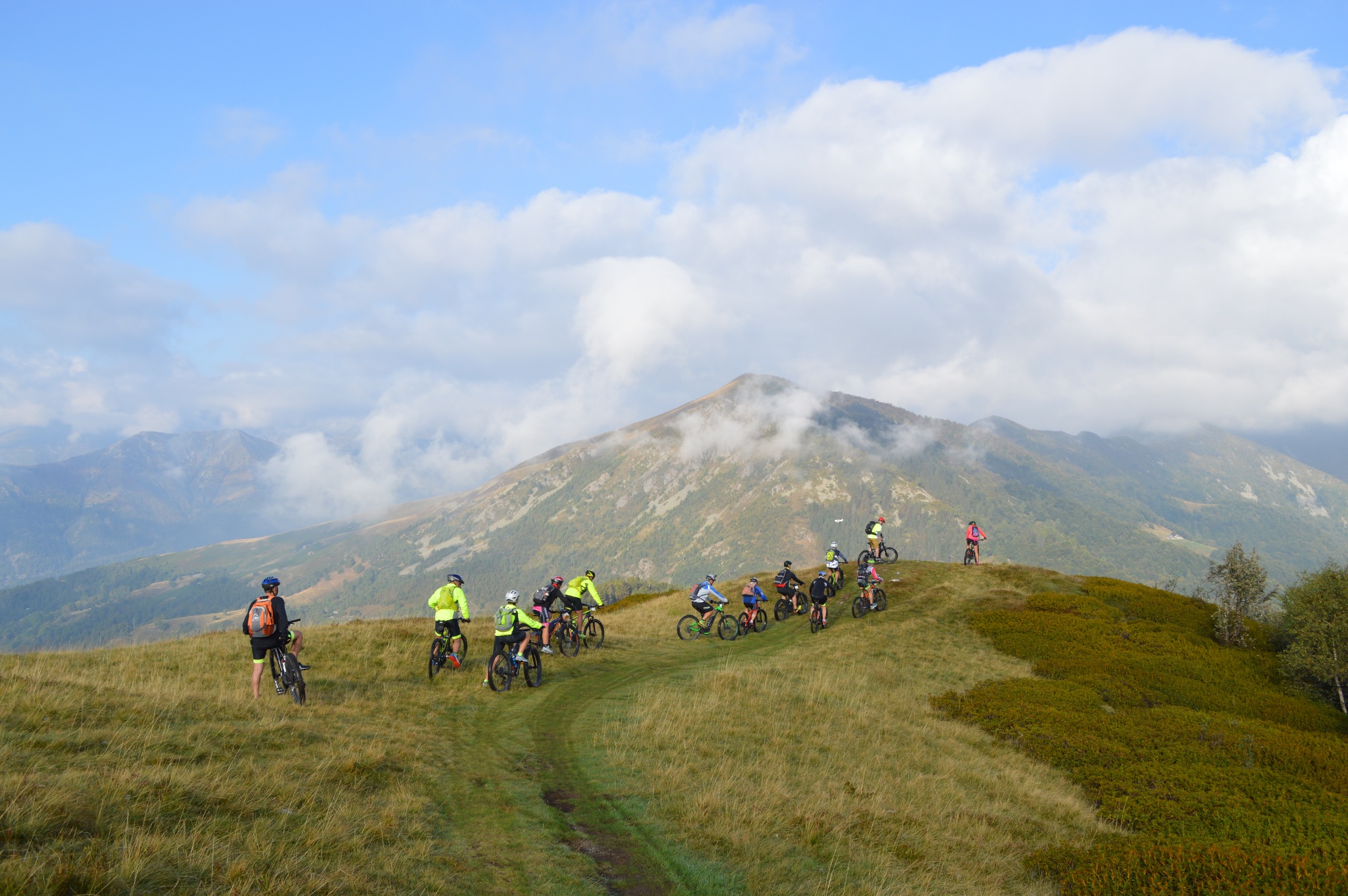
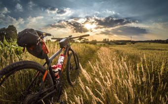
Bike path Scopello-Mera-Meggiana-Rassa-Scopello
Route / Bike
MTB
Bike path Scopello-Mera-Meggiana-Rassa-Scopello
Difficulty: medium
Distance: 38 km
average duration: 3 hours
Departure altitude: 1441 mt
arrival altitude: 1440 mt
altitude difference: 360 mt
Route description
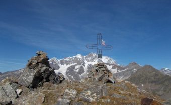
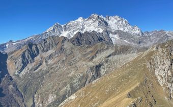
The bike path starts in front of the arrival of the Scopello-Mera chairlift, where a steep ramp leads to the foot of Mount Camparient.
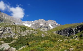
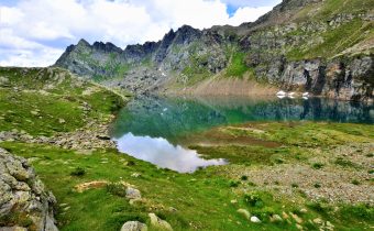
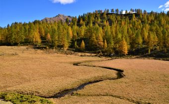
A striking view of Monte Rosa guides the route, which with very small elevation changes crosses the entire Alpe di Mera among magnificent rhododendron and blueberry bushes to Colle d’Ovago, below Monte Ometto.
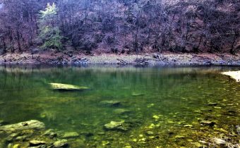
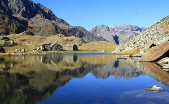
From here you continue at altitude without any particular difficulty until you reach first Alpe Meggiana, at the height of the charming Lake of Pizzo, then with moderate gradient Alpe Sorbella from where you descend with a dozen hairpin bends reaching the bridge that crosses the Sorba stream.
This stretch, although wide, requires for the slope and the bottom an adequate preparation. It is therefore recommended to get off the vehicle by accompanying it on foot.
The next section of the dirt road route leading to Rassa is of moderate gradient and presents no particular difficulty. On a paved road, you will come downhill in a few kilometers to the Quare bridge to rejoin itinerary No. 1. At this point it is possible to choose whether to continue toward Alagna or return to Scopello as the more classic route provides.
Other paths
recommended
Discover the bike trails that Valsesia has to offer!
Bike and Mtb tours through breathtaking views surrounded by the nature of Valsesia
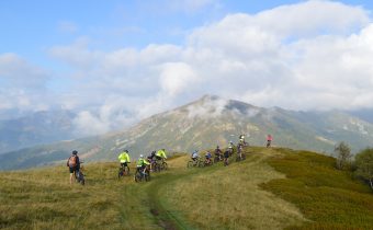
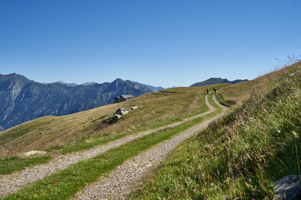
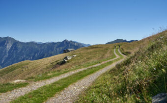
Bike path Alpe di Mera-Bielmonte
Route / Bike
MTB
bike path Alpe di Mera-Bielmonte
Difficulty: medium
Distance: 20 km
average duration: 3 hours
departure altitude: 786 mt
arrival altitude: 831 mt
altitude difference: 360 mt
Route description
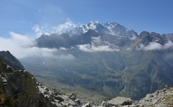
The uniqueness of this itinerary is definitely to unite, while remaining at altitude, two provinces of Piedmont. Riding it means exploring Valsesia but also Valsessera, and cycling in one of the most appreciated and well-known parks in the region, Oasi Zegna.
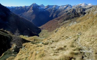
With a pleasant and scenic chairlift ride, you reach Alpe di Mera. From here descend along the carriage road for about 2 km. to the junction for Bocchetta della Boscarola.
Always follow the yellow sign with the stylized figure of a cyclist and the number 3 in a red field. A smooth dirt road leads up to the 1,423-meter elevation of the Col, with a gentle climb about 2.5 km long.
This is followed by a downhill section, to Dolca, and then an alternating 10-km-long climb and descent to the Fisherman’s House.
From this point the ascent resumes, for about 5 km, until the arrival in Bielmonte through Bocchetto Sessera.
The route runs mainly within the Zegna Oasis in the Alta Valsessera Regional Forest.
The bicycle path is wide and smooth the entire way. The apparently unimpressive duration should be calculated taking into account also the return, which if done in the saddle doubles km and hours indicated.
Other paths
recommended
Discover the bike trails Valsesia has to offer!
Bike and mountain bike tours among Valsesia’s breathtaking views.
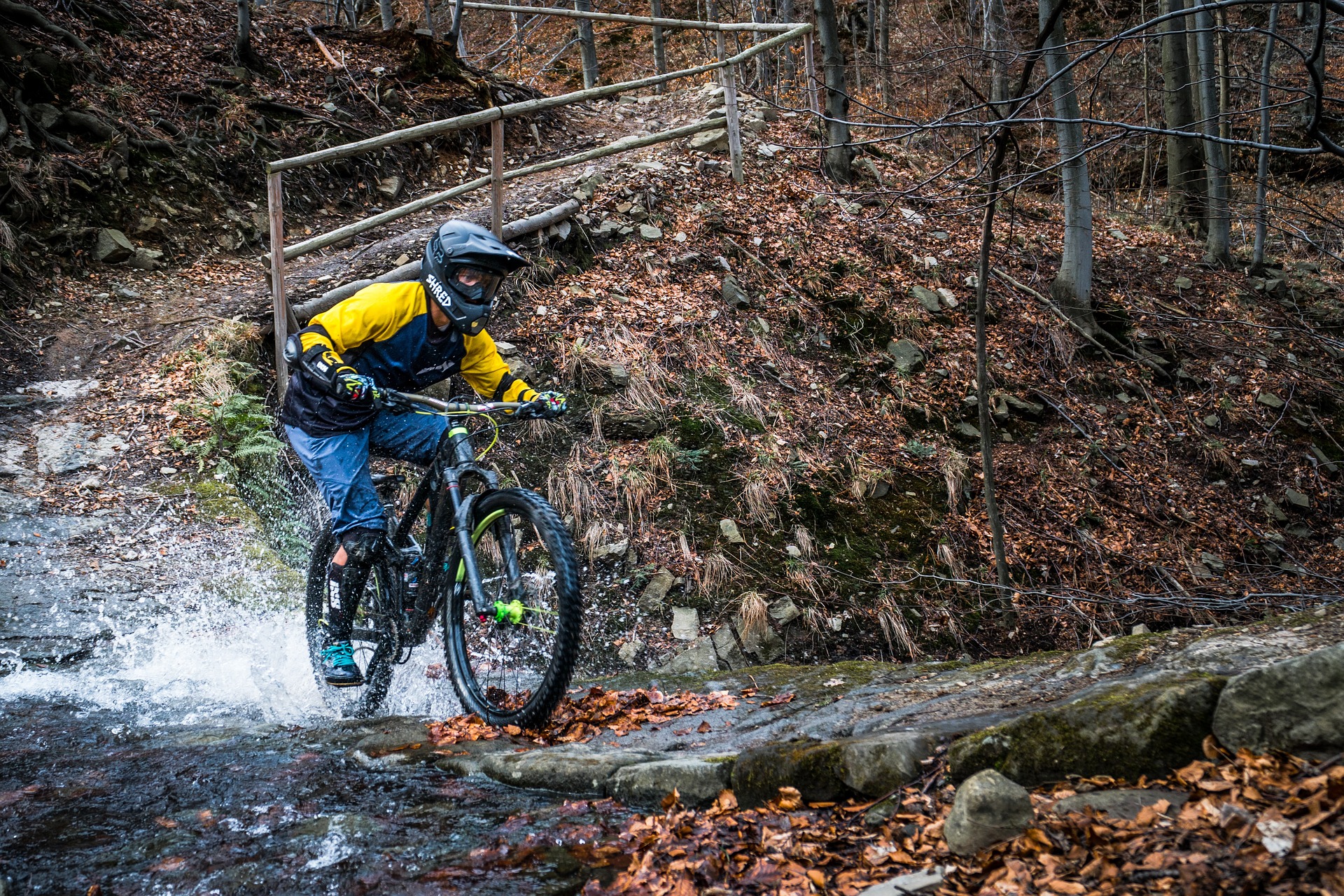
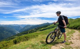
MTB routes of Serravalle Sesia
Route / Bike
MTB
MTB routes of Serravalle Sesia
Route Description
Climbs on sometimes steep dirt roads, adrenaline-fueled descents and lots of fun: this and much more in the woods of Serravalle Sesia!
With your mountain bike you can climb to gain the descent, ride among friends, meet new places and confront each other on the descent to see who is the fastest. The climbs serve mainly as transfers to reach the start of the adrenaline-filled descents: trails of varying difficulty that between jumps, turns and descents are ideal for those looking for fun and speed.
These trails for mtb downhill enthusiasts are known as the “Sentieri E-Gravity Team“.
Enduro is the ideal discipline for the all-around biker who wants a means to do everything, who likes long rides on his bike, who does not necessarily want to use mechanized ascents, and who most of all loves downhill competition.
Numerous trails are constantly cleaned and monitored so that everyone can enjoy smooth and fast descents.
If you do not have adequate training, the use of an E-Bike is recommended.
Other routes
recommended
Discover the bike trails that the Province of Vercelli has to offer!
Bike and Mtb excursions through breathtaking views immersed in the nature of Vercelli and Valsesia
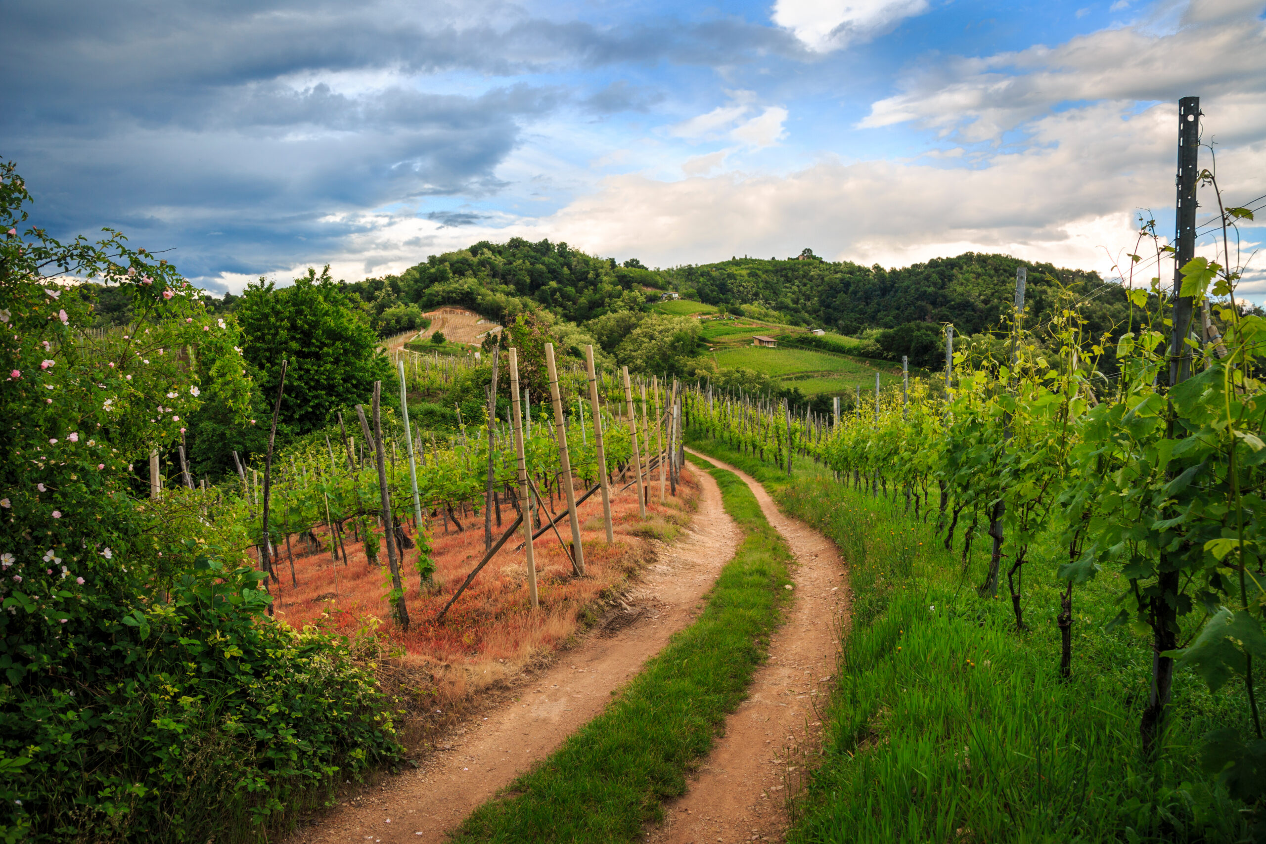
Mtb among the vineyards of Gattinara
Route / Bike
MTB
Mtb among the vineyards of Gattinara
Route Description.
From the center of the pretty town of Gattinara, the mtb ride begins among the vineyards of its beautiful hills. The asphalt climb will take you to a scenic first stop: the Castelle Tower, with its Giant Bench. Continuing along a mostly unpaved road, you will reach the Castle of San Lorenzo, the highest point in Gattinara, from which you can enjoy an exceptional view of the mountains, the hills and the city.
From the castle you continue pedaling toward the Nervi vineyards and the panoramic terrace of the same name. From here you can then return to Gattinara by following the road that descends to the foot of the vineyards
Along your route you cannot fail to notice three beautiful art installations depicting characteristic chalices, placed at scenic points: the Vie dei Calici.
The hills of Gattinara, in addition to offering beautiful views and trails among the vineyards for relaxation, also provide a good adrenaline rush: just between the woods and vineyards there are numerous trails dedicated to enduro, for those who are looking for a little speed. These trails for fans of mtb descents, are known as “I Sentieri dei Gatti”, The Cat Trails.
Riding your bike, get ready to ride on uphill roads through the vineyards that connect to the start of the different trails that, with adrenaline-fueled curves and descents, will take you back to the foothills.
If you do not have adequate training, the use of an E-Bike is recommended.
Other paths
recommended
Discover the bike trails that the Province of Vercelli has to offer!
Bike and Mtb excursions through breathtaking views immersed in the nature of Vercelli and Valsesia
Le Rive Rosse in MTB
Route / Bike
MTB
Le Rive Rosse in MTB
Route Description.
The small wine-producing village of Roasio is known among mountain bike enthusiasts for its trails leading to the Rive Rosse, a hilly area known for its reddish soil and rocks, which give the landscape an almost surreal feel.
It’s the ideal place for those who want to explore a unique mountain bike landscape, with varying levels of difficulty depending on everyone’s fitness level, from beginners to experts.
Challenging climbs on dirt roads alternate with wonderful, well-groomed single tracks: descents of varying difficulty, fun, and scenic!
Many trails are constantly cleared and monitored, allowing everyone to enjoy smooth, fast descents.
Furthermore, the Rive Rosse area also boasts a mountain bike school for children aged 6 and up: lessons are designed to teach youngsters how to master the use of a bike and how to tackle obstacles and various types of off-road terrain.
If you are not adequately trained, using an E-Bike is recommended.
Other paths
recommended
Discover the bike trails that the Province of Vercelli has to offer!
Bike and Mtb excursions through breathtaking views immersed in the nature of Vercelli and Valsesia

ALAGNA – Capanna Giovanni Gnifetti
Route / Trekking
Hikes
trail n. 205 Alagna – Capanna Giovanni Gnifetti
Difficulty: difficult
average duration: 7 hours
departure altitude: 1191 mt
arrival altitude: 3647 mt
altitude difference: 2456 mt
Route description
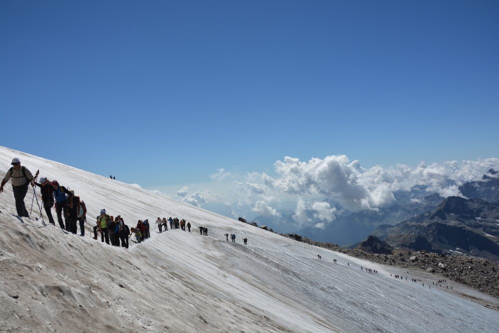
In the past it was one of the most frequented routes: in fact, it was the most convenient pass from Alagna to Gressoney and the route to Col d’Olen. Nowadays, to take one quickly to higher altitudes one preferably uses the ski lifts: from Alagna one takes the cable car to Pianalunga, then the Funifor that leads to Passo dei Salati, and one can push on to the edge of the glaciers with the Punta Indren station (3,275 meters above sea level) for alpine ascents.
Wanting instead to walk the entire itinerary, from the center of the village of Alagna, go up to the cableway departure station where the path on the right begins, leading to the hamlets of Dosso (Fum Diss) and Piane (Fum d’Boudma). After crossing the hamlet, follow a section of unpaved road and then follow the path that crosses the Olen stream over a bridge. You return to the road and then take the mule track to the left that crosses the ski slope and climbs into the woods.
You leave the woods near Zar Oltu and pass the Oltu Alp, from which you reach the slope and soon afterwards arrive at Zam Seiwji and Undre Seiwji, picturesque places with green and scenic plateaus on which a number of alpine pastures and refuges lie. Continue on the trail beside the hut and you will reach Alpe Pianalunga, 2025m (about 1h45). Continue in sections along the ski slope, in sections on the trail, and after a short ascent you reach the Fontanone plateau. From here the trail continues past a large split boulder in the middle, Sasso del Diavolo (Der Prebet stein), 2418m.
Continue along the mule track that faces the steep slope and reach the junction with trail 205d, which to the left leads shortly to Col d’Olen, 2881m.
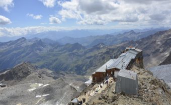
Immediately afterwards you approach the square where the historic Albergo Guglielmina, destroyed by fire, used to be, and then the Rifugio Città di Vigevano, 2864m (about 4 hours). you then reach the small chapel dedicated to the Vergine del Rosa and continue, leaving the refuge to the right.
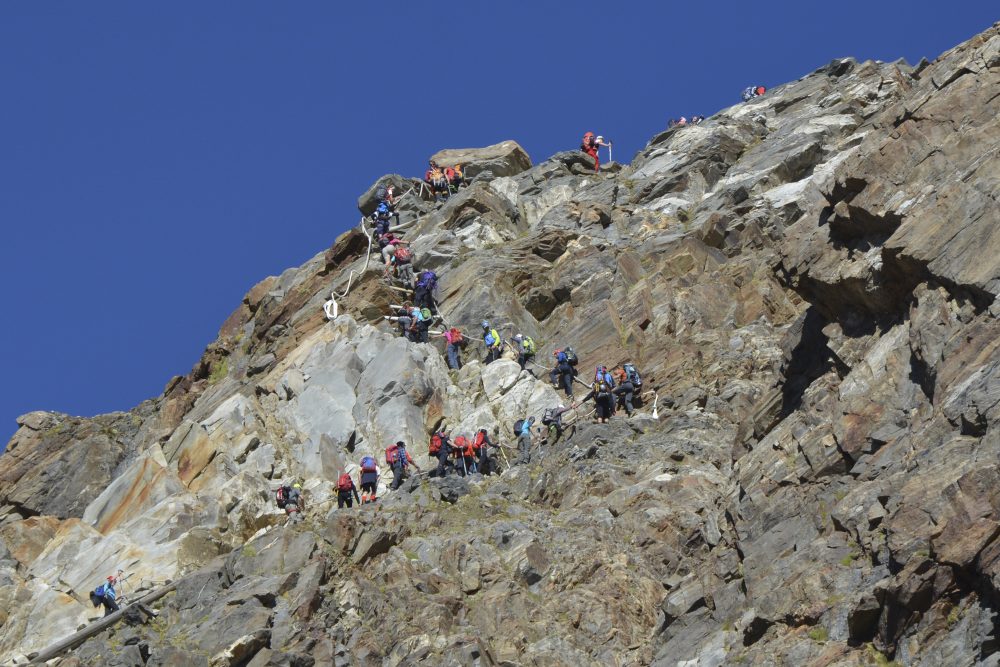
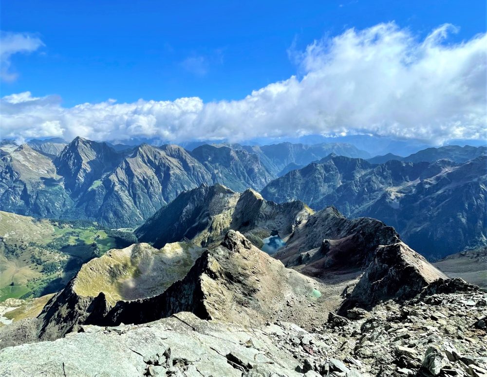
You pass by a small lake and return to the ski slope near the A.Mosso International Scientific Institute, an historical research center at 2,901 meters above sea level. You then reach Passo dei Salati, 2936m (in about 5 hours total), the arrival point of the cable car stations from Alagna and Gressoney. Not far away there is the departure station for the Indren cable car. A good, wide path leads up to the Stolemberg, 3202m. About a hundred meters from the summit, bend left on the Aosta Valley side and descend to the Upper Pisse Pass, 3112m, with a few sections equipped with fixed ropes. The trail climbs to the ridge and leads to Colletto dell’Acqua, about 3200m, from where with a short climb you reach the old Punta Indren station, 3254m. A traverse to the northwest takes you to the new cable car station at 3275m.
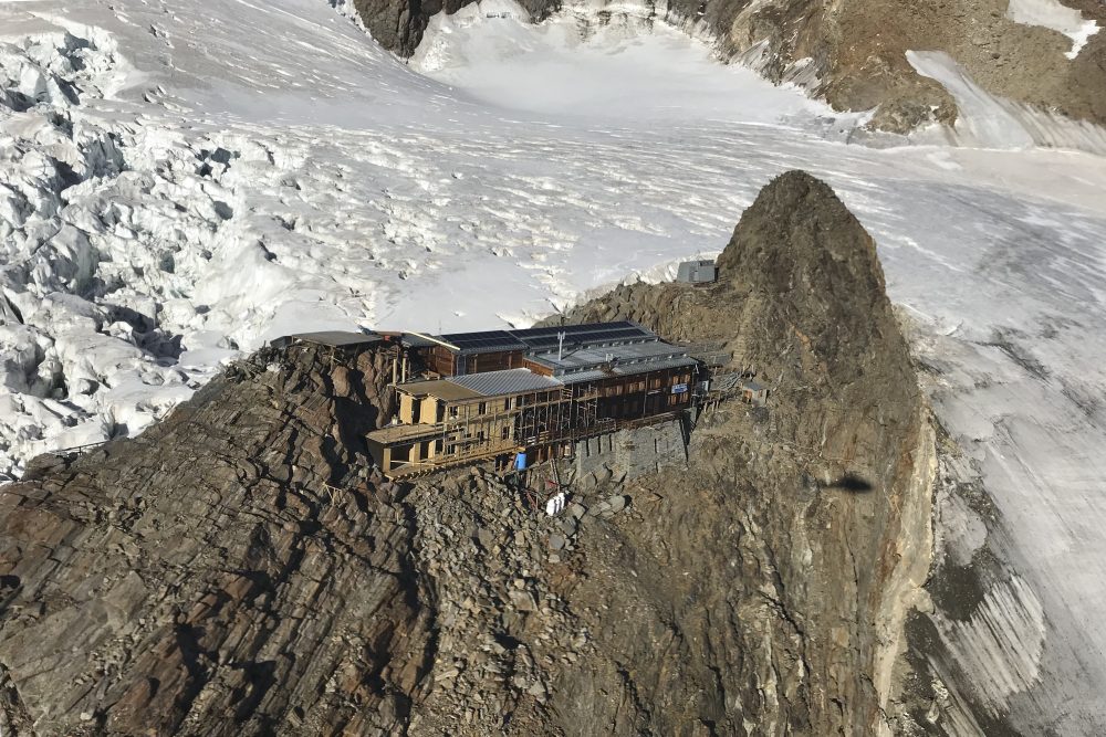
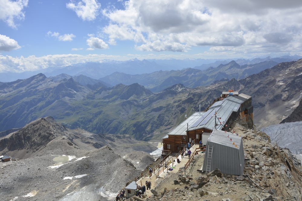
From here the itinerary becomes mountaineering; it is necessary to cross the Indren Glacier with some crevasses, overcome rocky edges with sections equipped with ladders and cables to reach the Giovanni Gnifetti Hut, 3647m (total about 7h), flanked by the little church of the Madonna dei Ghiacciai.
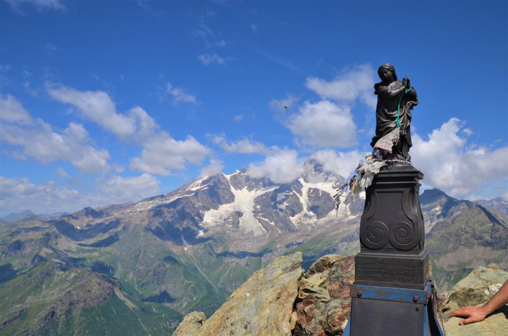
Several traverses and numerous ascents can be made from the Gnifetti Hut: Pyramid Vincent, 4215m, Balmenhorn, 4167m (with the hut of the same name and the statue of Christ of the Summits), Black Horn, 4322m, East Lyskamm, 4527m, Parrot Peak, 4436m, Punta Gnifetti (Signal Kuppe), 4554m, Punta Dufour, 4634m.
On Punta Gnifetti rises the Regina Margherita hut. 4554m, the highest refuge in Europe.
Other routes
recommended
Valsesia has a lot to offer to hiking enthusiasts
Suggestive trails surrounded by nature that offer breathtaking views: be surprised by the beautiful mountains of Valsesia!
how to get there
info and contacts
C.A.I. – Club Alpino Italiano di Varallo Sesia
ALAGNA – Rifugio Pastore – Capanna Gugliermina
Route / Trekking
Hikes
trail n. 206 Rif. Pastore – Capanna Gugliermina
Difficulty: DIFFICULT
average duration: 5-6 hours
starting elevation: wold parking lot 1278 mt
arrival altitude: 3212 mt
altitude difference: 1821 mt
Route description
To reach the beginning of the itinerary, one must follow the road from the village of Alagna to the Wold square, 1278m, where one can park the car. (In the summer months you can use the Wold – Acqua Bianca shuttle service for a fee).
Those who proceed on foot, either by choice or during the periods when there is no shuttle service, follow the paved road not open to traffic and, a little further on, can choose between two options: take the path on the left bank of the Sesia, No. 206 which arrives behind the Pastore Refuge in about 1h, or continue always on the paved road until reaching the Acqua Bianca Waterfall in about 45min (arrival of the summer shuttle), from where first a mule track and then a steep staircase starts to reach the Alpe Pile, from where you then follow the path that descends to the left, crossing a pretty wooden bridge that leads to the Pastore Refuge.
Turning your back to the Refuge, follow trail 206 to the left, which flanks the Sesia River at a distance, touches Alpe Casera Lunga (Zam Lange Gode) and reaches the bridge over the Rio Bors, 1700m. We leave trail 210 (which goes up the Vallone di Bors towards Bocchetta delle Pisse) on the left, and continue our route following trail 206, which climbs the valley floor of the Sesia among large alluvial and moraine blocks and lush vegetation.
It then continues downstream from Alpe Muflicat and arrives at the ford of the stream that descends from the Piode Glacier: in summer, the volume of water can cause significant crossing difficulties, especially in the afternoon.
Past the stream, the trail continues almost level and then faces the steep slope where the trail becomes more uncertain and climbs to on the steep moraine ridge. It crosses to the right over large scree and points to the rocks of Parrot Point.
You ascend the rocks facilitated by a series of artificial equipment and with some easy climbing reach the Gugliermina Hut (ex Valsesia), 3212m (total about 5 hours), always open and unattended. The Hut was designed by Brothers Giovan Battista and Giuseppe Fortunato Gugliermina to facilitate ascents from the southern slope of Monte Rosa.
The Hut is a starting point for important and challenging climbs: Punta Parrot, 4436m; Ludwigshohe, 4342m; Corno Nero, 4322m; Piramide Vincent, 4215m; and Punta Giordani, 4046m.
Other routes
recommended
Valsesia has a lot to offer to hiking enthusiasts
Suggestive trails surrounded by nature that offer breathtaking views: be surprised by the beautiful mountains of Valsesia!
how to get there
info and contacts
C.A.I. – Club Alpino Italiano di Varallo Sesia

RIVA VALDOBBIA, Fraz. Sant’Antonio – Corno Bianco
Route / Trekking
Hikes
trail n. 202 S. Antonio – Corno Bianco
Difficulty: EEA – Experienced Hikers with Equipment
average duration: 5-6 hours
departure altitude: 1380 mt
arrival altitude: 3320 mt
altitude difference: 1940 mt
Route description
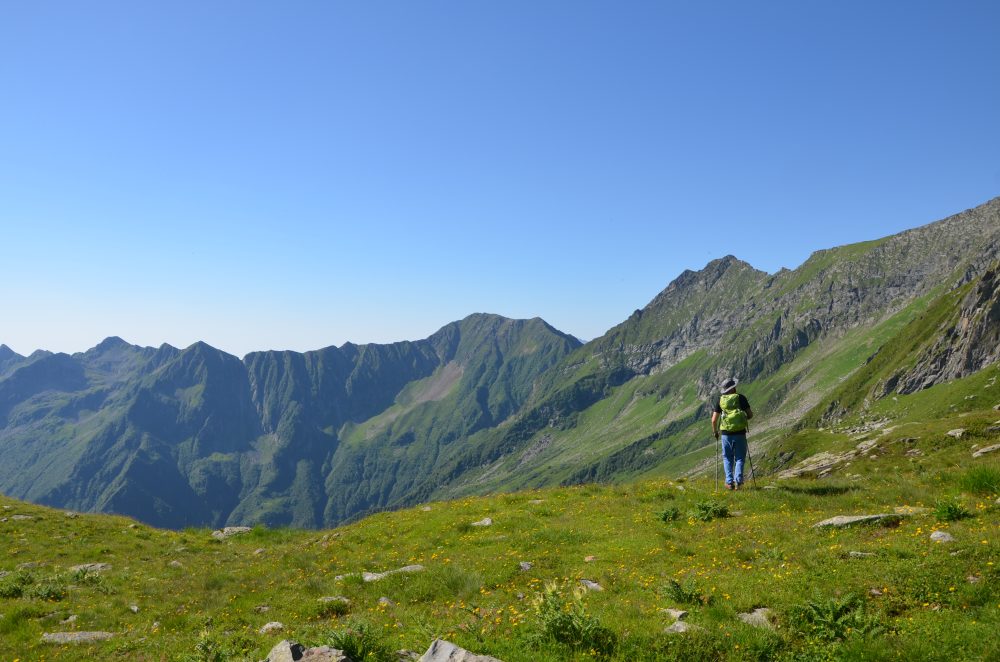
This route is the main route to Corno Bianco, one of the most important and scenic peaks in Valsesia! Caution: basic mountaineering skills are required beyond Black Lake.
To reach the starting point of this itinerary, from the village of Riva Valdobbia, walk along the paved carriage road to the hamlet of Ca’ di Janzo, then continue always on the road (partially subject to transit restrictions, during the summer season) to the hamlet of Sant’Antonio, where you can park your car (arrival point of the Ca di Janzo – Sant’Antonio summer shuttle).
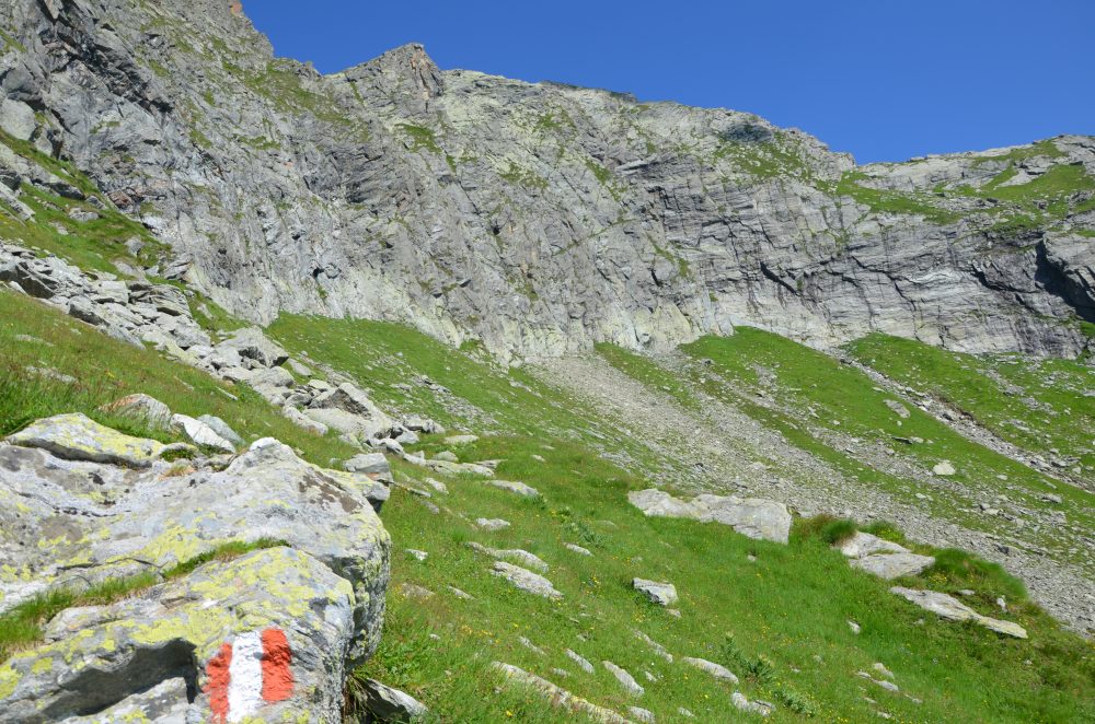
Starting on foot on the dirt road past the houses and the little church of the hamlet, follow trail marker 201 to the junction at an altitude of about 1400m (reachable in about 30min). Here the path begins by climbing to the right, indicated by some CAI signs and the wooden sign of the refuge. You then reach the hamlet of Cambiaveto, which you immediately leave to take the path to the left that climbs and crosses the valley. Turning left you pass above the hamlet of Piane, 1494m. You cross the pasture and face the tightly winding ascent that leads to Alpe Spinale, 1904m. With another uphill stretch you reach the Carestia Refuge, 2201m (in about 2 hours). The trail continues high up the mountainside, accompanied by beautiful views of the Rissuolo waterfall, Rifugio Ospizio Sottile and Alpe Larecchio. Leaving the ruins of Alpe Pile Vecchie below, you cross a stream in the scree and arrive at the former Alpe Rissuolo Support Point, 2264m.
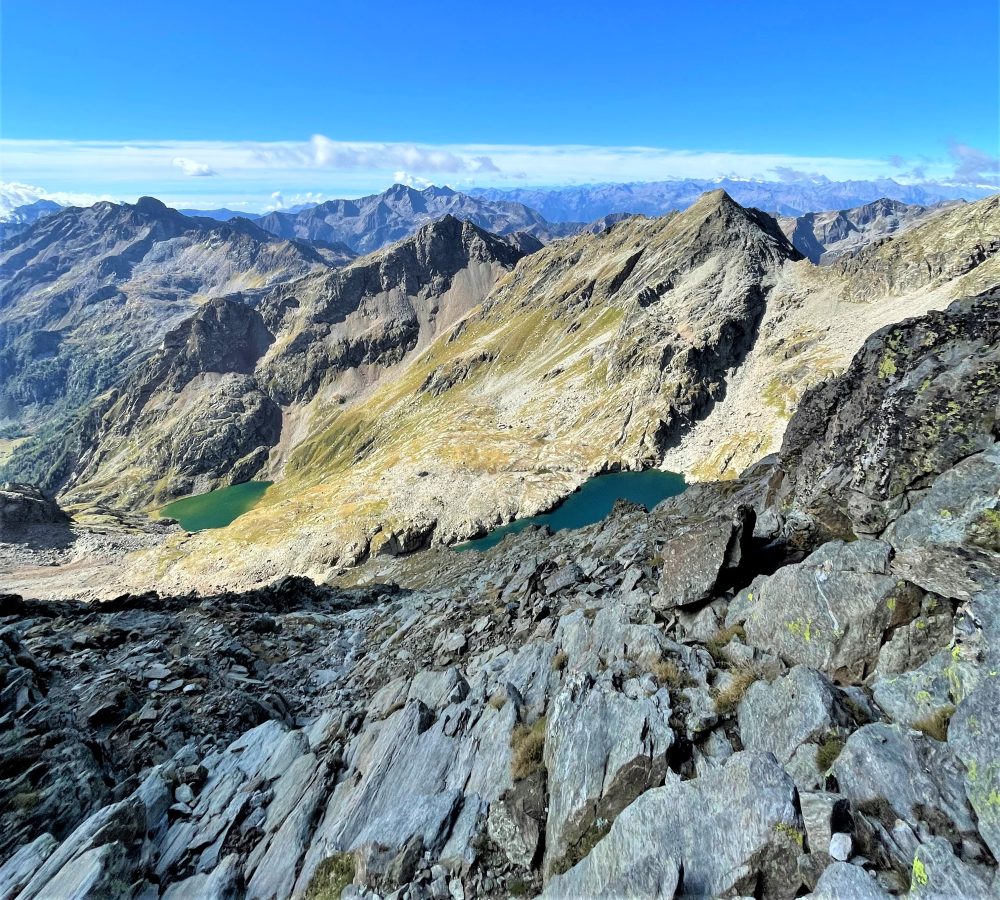
You then enter Vallone Rissuolo, passing the waterfall and flanking the stream to shortly reach Lago Bianco, 2333m (about 2h30). Go around it passing a rocky spur and continue on scree. When you reach the bottom of the basin, you tackle the steep slope of meadows and slabs that leads to the upper shelf where the barren Black Lake, 2672m (about 3h30), is situated.
From here you head north to a black: some fixed chains and appropriate handholds allow you to cross this aerial and exciting passage.
You ascend the overhanging gully and about halfway up take a left into a parallel gully. Following the southeast ridge, with a route over exposed rocks, climb to the summit of Corno Bianco, 3320m (total about 6 hours).
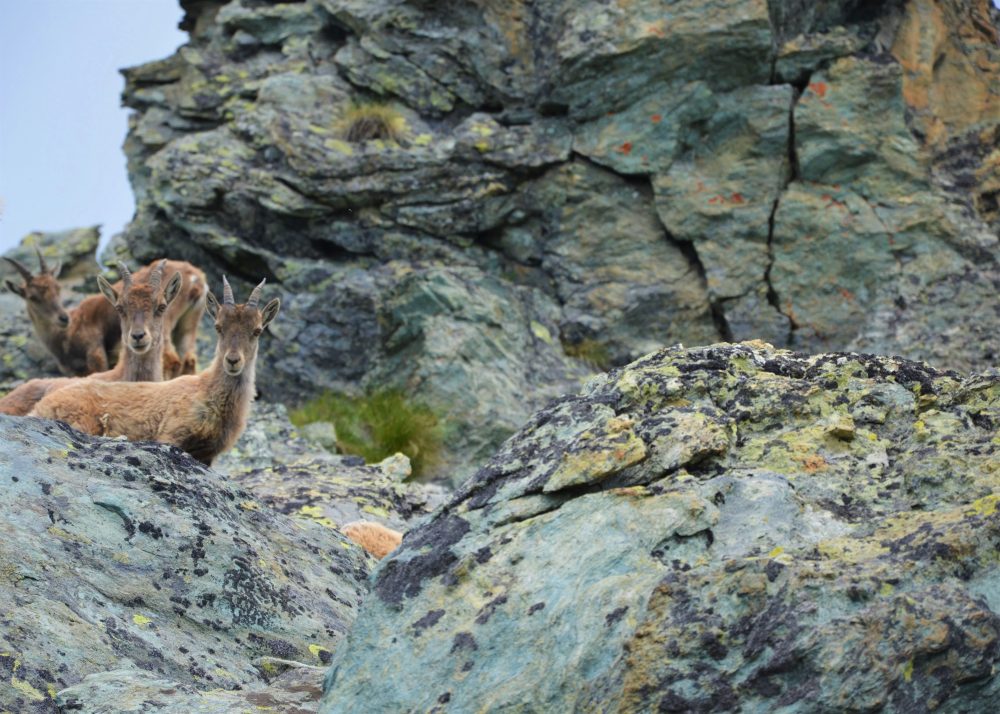
From the summit the view is exciting and unique: it overlooks the alpine circle, the plain and especially the southern slope of Monte Rosa. Although the ascent has some difficulties and a long way to go, the great variety of landscapes, alpine lakes and views definitely repay the effort!
Other routes
recommended
Valsesia has a lot to offer to hiking enthusiasts
Suggestive trails surrounded by nature that offer breathtaking views: be surprised by the beautiful mountains of Valsesia!
how to get there
info and contacts
C.A.I. – Club Alpino Italiano di Varallo Sesia

RIMA – Monte Tagliaferro
Route / Trekking
Hikes
trail n. 318 Rima – Monte Tagliaferro
Difficulty: EE – Experienced Hikers
average duration: 4 hours
departure altitude: 1411 mt
arrival altitude: 2964 mt
altitude difference: 1553 mt
Route description
The route starts from the village of Rima, 1411m, and the first part of the trail is shared first with the 292 mule track to the Little Altar Pass, and then with the 296 to the Mud Pass, up to an elevation of about 1700m (in about 30/45min). Abandoning the mule track, take trail 318, which drops off to the left, crosses the Rio Valmontasca and continues on level ground to Alpe Scarpia di Sotto, 1712m.
Proceed diagonally uphill to reach Alpe Scarpia di Sopra, 1916m. From the alpine pasture move left and reach a large boulder near which flows a spring and on which is placed a plaque. Climbing to the left through pastures and slabs we reach Vallarolo Pass, 2332m.
Our route points west instead and reaches a giant boulder that provides precarious natural shelter. The trail accentuates the slope until it takes you below the vertical of a very steep grassy slope for which, with narrow, exposed switchbacks, you gain the Passo del Gatto, 2730m, (in about 3 hours). On the opposite side climbs the track from Bocchetta della Moanda, recently equipped by Alagna guides; EEA.
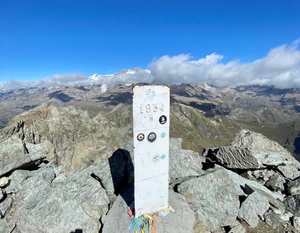
Turning right, follow the trail that cuts across the steep mountainside and reaches the ridge of rocks and boulders that leads to the summit of Mount Tagliaferro, 2964m, (in about 4 hours total). From the summit the view is unique and breathtaking, a veritable window looking directly into Monte Rosa!
Other routes
recommended
Valsesia has a lot to offer to hiking enthusiasts
Suggestive trails surrounded by nature that offer breathtaking views: be surprised by the beautiful mountains of Valsesia!

How to get there
Info and contacts
C.A.I. – Club Alpino Italiano di Varallo Sesia
BORGOSESIA fraz. Foresto – Monte Tovo – Castello di Gavala
Route / Trekking
Hikes
trail n. 715 Borgosesia, fraz. Foresto – Monte Tovo – Castello di Gavala
Difficulty: EE – Experienced Hikers
average duration: 4-5 hours
departure altitude: 371 mt
arrival altitude: 1827 mt
altitude difference: 1456 mt
Route description
The route touches the highest peaks in the town of Borgosesia.
The route begins near the parish church of Isolella, 371m, following the municipal road of the hamlet of Foresto until it reaches the first hairpin bend. Here you take a wide mule track that climbs keeping to the right for a good stretch. Passing an oratory, you reach, in about 30 minutes, Foresto, 551m in the vicinity of the cemetery and parish church dedicated to St. John. (You can also get to Foresto by car).
Enter the village and continue to reach an old chestnut grove located above the hamlet of Costa, via a mule track. Leaving two farmsteads on the left and crossing a chestnut forest, you reach the inter-modal road of Monte Tovo, cross it and proceed on the mule track that leads to the Fontana degli Alpini. The route climbs and skirting the pine forest reaches Alpe Bonde, at an altitude of 945m. It then proceeds along the hairpin bends of the trail through a beech, fir and birch forest to meet the road again at Alpe Stanvone, 1092m.
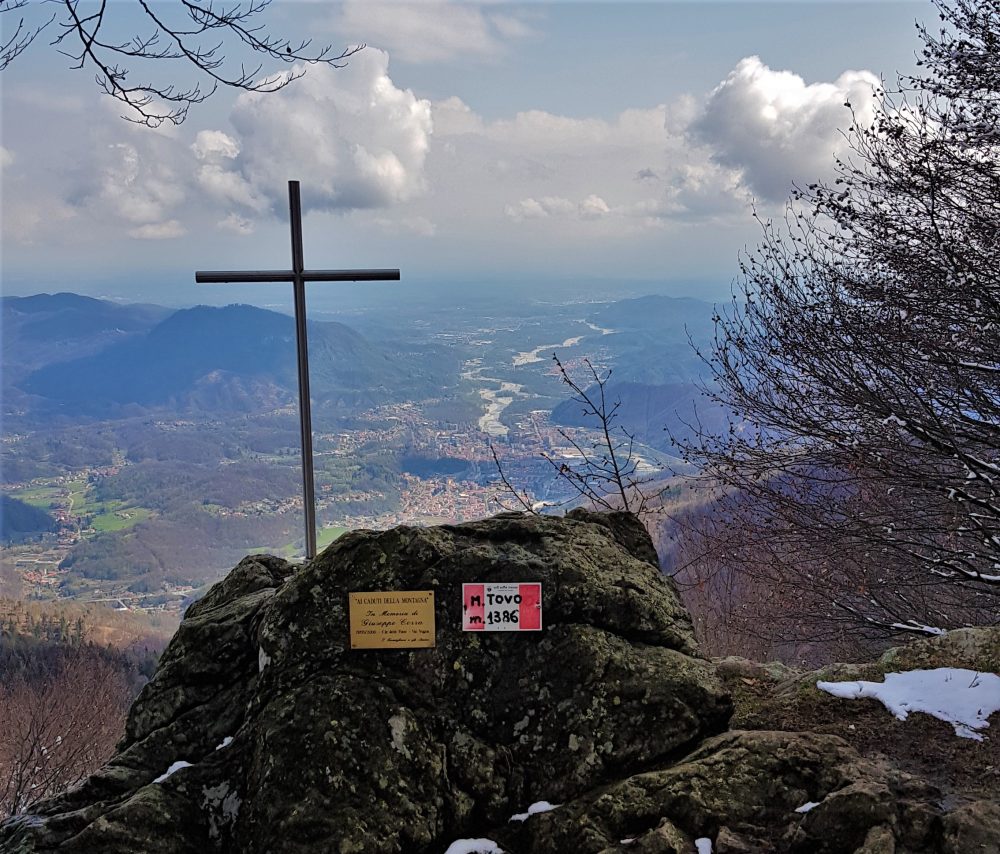
You pass the fountain and quickly climb to Rifugio Luciano Gilodi (Cà Mea), 1110m. You can also reach the Refuge, which is below the summit of Mount Tovo, by car.
Behind the hut one climbs up the road and reaches the large square overlooked by the pretty little chapel with a view of Borgosesia. From here you can climb to the extreme tip of Mount Tovo, where a symbolic cross rests, by climbing up the path on the wide slope to the right. Instead, the itinerary continues on the wide unpaved road on the right into the beech forest and reaches a shoulder of the Falghé hump, at the point where it intersects with itinerary 713, which leads from Doccio to Monte Tovo.
Proceed always keeping to the right along the dirt road that with several ups and downs reaches Sella della Rosetta, 1246m. From here, continue on the path that runs along the ridge reaching a grassy shelf, the Soglio, the arrival point of the itinerary coming from Doccio.
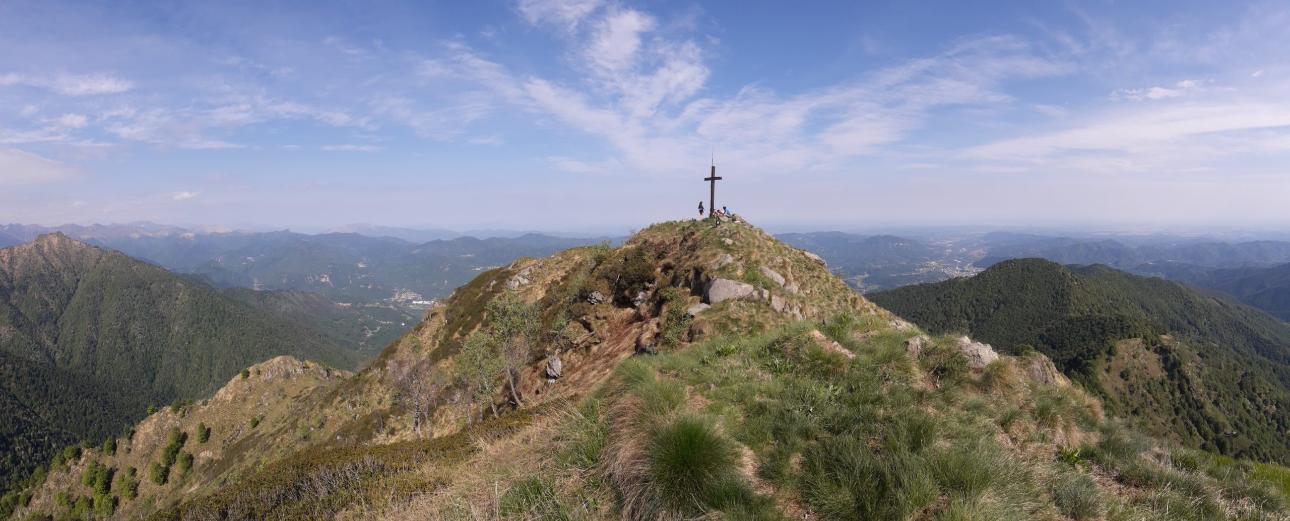
Proceeding on the Doccio side, you climb a gully that comes out on the ridge; you then pass on the Postua side (left), passing a ledge under a wall: the “Balmaccia.” You then reach the Sella del Casone by climbing a gully until below the anticima. Having circumvented the anticima in a steep section that requires caution, one arrives by walking a few more minutes to the summit of Mount Luvot, 1603m, symbolized by a large cross. In his “Guide to the Mountains of Valsesia,” Don Ravelli refers to it as Sasso di Soliva or Baudrocco.
Then proceeding along the ridge and passing several humps, you go around, below the ridge, on the Valsesian side, the Terraggiolo peak, 1656m. Instead, proceed following the ridge until you reach the first rocks of Gavala. Bending to the right, you flank the Locarno slope. Ascending by traces the ridge toward the west summit, then passing a small gully, you reach the first one. Later, past a second big head on the right, you pass a saddle where there are trail tracks leading along the ridge toward Massale and Res. From the saddle, via an exposed section, you can reach the main summit of Gavala Castle, at an altitude of 1827m.
Other routes
recommended
Valsesia has a lot to offer to hiking enthusiasts
Suggestive trails surrounded by nature that offer breathtaking views: be surprised by the beautiful mountains of Valsesia!